fbpx

Story Behind the Photo: “Snake River” by Kyle Aiton

[et_pb_section bb_built=”1″][et_pb_row][et_pb_column type=”4_4″][et_pb_text _builder_version=”3.13.1″]

Ask most photographers about that “perfect” shot and they’ll tell you that while their craft involves skill, practice, and technique, there is also a certain amount of luck. So was the case for Kyle Aiton and the image he captured at dawn on the Snake River, which we featured in our 2018 calendar.

“I lucked out big time on that shot,” Aiton confessed. He was in his own kayak, trying to capture and set the tone from behind his lens. “I had been solely looking in the other direction, up-river and facing forward. But then I turned around and I saw the steam on the water. I saw the sun coming up. I just love that shot. Sometimes the scenery does all the work for you and you just have to press the shutter button.”

The image, although shot in color, shines with sepia tones in the fresh sunlight peeking over the mountain top. In the foreground, a kayaker deftly maneuvers his oar as water spills across his kayak. Further back, a group sits in a shadowed raft, and your eye is led down the glowing, tree-lined curve of the Snake as mist floats above the surface. It’s the kind of photograph that makes you instantly appreciate the beauty of this natural treasure and explains why people from across the globe come to fish, paddle, and just be in the presence of the mighty Snake River.

Aiton was on the water that morning as a photography instructor for Summit Workshops, a national organization that pairs students with mentors to hone their craft in stunning natural settings. It was the fourth day of a week-long adventure that had included trail running, rock climbing, kayaking, and fly fishing.

“We had arrived when it was still dark and cold,” he said. “Some people were nervous — they had never been on the water before. But soon you could sense everyone relax and get comfortable with just how amazingly beautiful it was.”

A full-time freelance photographer, Aiton had joined the workshop as a way to combine work, travel, and outdoor recreation. He grew up in North Carolina, and moved to Wyoming after college (the first time he’d been west of the Mississippi) to pursue an AmeriCorps position in Cheyenne building Habitat ReStores. He immediately fell for the West’s vast landscape, and for the past 10 years he’s split his time between Wyoming, Colorado, and Utah. But no place, he says, has ever left an impression on him like Wyoming has.

“The absolute solitude and drastic differences in landscapes you experience between Cheyenne and north towards Sheridan or west towards the Tetons” provide an indelible perspective, he said. Aiton discovered the many contrasts of Wyoming just as contrasts were happening in his own life. “Not only is Wyoming beautiful, I moved here at such a pivotal time in my life. It was a new chapter, and everything was new to me, so it was very impactful.”

It was in Wyoming that Aiton took up photography and began spending more time outdoors. He has a hand-me-down camera and started shooting his outdoor adventures with friends. Although his initial images weren’t his best technically, he was impressed with the content — people recreating and doing the things they love in dramatic landscapes.

He was honored to have his photograph selected for our 2018 calendar, and he said it made him feel proud to know he might be contributing to a greater cause just by “taking a beautiful picture of a beautiful place so that other people can appreciate it.”

The Snake River that Aiton captured flows south through Jackson Hole and cuts west between the Teton and Wyoming mountain ranges. It is renowned for its blue ribbon native trout fisheries — a vital resource in a landscape we have worked to protect over the past decade.

In 2013, after years of work with numerous partners, we celebrated the purchase and retirement of nearly 60,000 acres of oil and gas leases in the Upper Hoback Basin of the Wyoming Range. Our “Don’t Frack the Hoback” campaign ensured the headwaters of the Congressionally designated Wild and Scenic Hoback River — which flows into the Snake — would not be the location of 136 new oil and gas wells.

This year, an additional 24,000 acres of leases were retired from oil and gas drilling as part of the continuing work of citizens and local leaders who value the area’s vistas, outdoor recreation opportunities, and diverse wildlife.

Join Aiton and other photographers by submitting your own shot of Wyoming for the Outdoor Council’s 2019 Calendar Contest. You can enter your photos via Instagram or email. To submit your photo(s) via Instagram, you must have a public Instagram account so that we’re able to view your submission. Upload your photo(s) and add the hashtag #MyWyoming.

To submit your photo(s) via email, send your photo(s) to claire@wyomingoutdoorcouncil.org.

For more information about the contest, visit our Calendar Contest page.

[/et_pb_text][/et_pb_column][/et_pb_row][/et_pb_section]

Energy Dominance: Wyoming is ground zero for ‘energy dominance’ mandate

[et_pb_section bb_built=”1″ _builder_version=”3.12.2″ custom_margin=”0px|||”][et_pb_row custom_padding=”0px|||” custom_margin=”0px|||” _builder_version=”3.12.2″][et_pb_column type=”4_4″][et_pb_text _builder_version=”3.13.1″]

A new “energy dominance” policy has made Wyoming ground zero for the Trump administration’s anti-regulatory, top-down mandate to promote energy extraction over all other uses on our public lands. And it’s affecting every aspect of the Wyoming Outdoor Council’s work.

Nearly half of Wyoming’s surface acreage is public land (Bureau of Land Management, national forests and parks) and the feds own and manage minerals underlying millions of additional acres of private land. During past administrations, the federal government has often served as a check on the oil and gas and mining industries’ wishes to forego a necessary balance of multiple uses. Now, the industry’s wish list is the federal mandate — and a strategy of systematically shutting the public out of decisions affecting our public lands is the new normal.

“Well established democratic processes — such as the ability to comment on proposed federal actions — are viewed by the Trump administration as impediments. This policy of ‘energy dominance’ seeks to remove those impediments,” Outdoor Council Senior Conservation Advocate Dan Heilig said. “These are our public lands, and we’re being shut out — project by project and policy by policy.”

Consider a few of the actions the administration has taken in the last year and a half that stem directly from an energy dominance policy:

• Issued an executive order in March 2017 calling for a review of all federal actions that could hinder the exploitation of energy resources and infrastructure, and immediately revoking many Obama-era measures to curb greenhouse gas emissions and protect against climate change.

• Removed regulations designed to improve the safety of hydraulic fracturing, as well as regulations seeking to reduce emissions and leaks of methane, a powerful greenhouse gas.

• Rescinded the BLM’s oil and gas leasing reforms.

• Convinced Congress to scrap the BLM’s “planning rule,” designed to increase citizen participation in land-management decisions.

• Issued guidance to federal agencies to “streamline” environmental reviews by imposing arbitrary page limits and timelines.

• Scaled back science-based protections in West-wide Greater sage-grouse conservation plans that protect habitat for some 350 wildlife and plant species.

• Offered oil and gas lease parcels in critical wildlife habitats, popular recreation areas, and culturally and historically important landscapes.

Fighting to Keep the Public in Public Lands


Among the hallmarks of the National Environmental Policy Act — our country’s bedrock environmental law — are its requirements for federal agencies to notify and respond to the public about actions affecting the air we breathe, the water we depend on, and the landscapes and wildlife that define our quality of life. These requirements are fundamental to ensuring that the public has a say in what happens to our shared resources.

Since January 2017, however, we’ve seen federal agencies give shorter notice for oil and gas lease sales and shorten the length of time the public can comment on actions related to energy development and the management of our public lands.

Conservation organizations and citizens alike have also found it more difficult to ensure that our comments are even being considered. This year the BLM reported it couldn’t account for tens of thousands of missing public comments submitted in response to the Trump administration’s revised sage-grouse management plan.

Even federal employees who live in Wyoming confide their frustration that the democratic institutions that have long ensured public participation in federal policies are now being whittled away. These civil servants say they are relying on the public’s persistence and continued engagement.

Add to this Rep. Liz Cheney’s tellingly titled “Removing Barriers to Energy Independence Act” (HR 6087) to slap exorbitant fees on citizens who wish to protest oil and gas lease sales, and Sen. John Barrasso’s ONSHORE Act (S 2319) that would give authority to states to approve applications to drill on federal public lands, and it’s clear there’s a concerted effort to aid energy companies and remove the public from public lands management processes.

“We’re seeing policies coming out of Washington, D.C., to benefit the oil and gas industry,” Heilig said. “And their primary strategy? Putting up barriers to meaningful public input in agency decision making.”

What Energy Dominance Looks Like in Wyoming


Today, the BLM is ignoring past agreements with the state and offering lease parcels throughout southwestern Wyoming — including many inside critical wildlife habitats in the Greater Little Mountain area, in sage-grouse core areas, and in parts of the Northern Red Desert that have long been understood to be off limits to oil and gas development.

Even Interior Sec. Ryan Zinke’s overture to sportsmen — an executive order “to enhance and improve the quality of big-game winter range and migration corridor habitat on federal lands” — rang hollow. No sooner had Zinke signed the order than the Interior’s BLM proposed oil and gas lease parcels for sale inside the Red Desert to Hoback migration corridor — the longest mule deer migration ever recorded.

Although Gov. Matt Mead has urged the BLM to reconsider leasing in Little Mountain and the Red Desert to Hoback corridor, he and other elected leaders in Wyoming support many aspects of an energy dominance policy — which influences the actions of our state agencies. For example, the state’s wildlife and environmental quality officials are often reluctant to hold the line — or even weigh in — on efforts to roll back detailed, science-based wildlife stipulations and air quality measures carefully crafted under previous administrations. This is particularly concerning to those who live and hunt in eastern Wyoming, where the 5,000-well Converse County Oil and Gas Project (and other big drilling projects) are slated for approval within the next year.

And in July, Wyoming’s Office of State Lands and Investments offered dozens of oil and gas lease parcels in the Northern Red Desert — home to crucial winter habitat for big game, national historic pioneer trails, wilderness study areas, North America’s largest sand dune complex, and dozens of other historic, cultural, and natural resources. One parcel was even situated in the shadow of the iconic Boar’s Tusk.

These federal actions and policy changes are coming fast and furious. And they complicate nearly every aspect of our program work. Read on to learn what the Outdoor Council is doing to address these challenges and why we need your help.

[/et_pb_text][/et_pb_column][/et_pb_row][et_pb_row _builder_version=”3.12.2″][et_pb_column type=”4_4″][et_pb_text _builder_version=”3.13.1″]

The Energy Dominance Mandate at Work: WOC’s Response

[/et_pb_text][/et_pb_column][/et_pb_row][et_pb_row _builder_version=”3.12.2″][et_pb_column type=”1_2″][et_pb_text _builder_version=”3.12.2″ text_font=”||||||||” background_color=”#fcaf17″ border_radii=”on|1px|1px|1px|1px” border_width_all=”2px” border_color_all=”#344411″ box_shadow_style=”preset3″ custom_margin=”0px|||” custom_padding=”5px|10px|5px|10px”]

Problem: Rollback of BLM rule to protect air quality and curb greenhouse gases.

[/et_pb_text][/et_pb_column][et_pb_column type=”1_2″][et_pb_text _builder_version=”3.12.2″ text_font=”||||||||” text_text_color=”#fff5e7″ background_color=”#6a8a22″ border_radii=”on|1px|1px|1px|1px” border_width_all=”2px” border_color_all=”#344411″ box_shadow_style=”preset3″ custom_margin=”0px|||” custom_padding=”5px|10px|5px|10px”]

Solution We Seek: BLM keeps its good rule and Wyoming adopts strong statewide guidance.

[/et_pb_text][/et_pb_column][/et_pb_row][et_pb_row _builder_version=”3.12.2″][et_pb_column type=”4_4″][et_pb_text _builder_version=”3.13.1″ custom_margin=”-15px|||”]

In 2015 the BLM finalized rules to limit the venting and flaring of natural gas, and required inspections of leaky equipment for new oil and gas wells. Because the pollutant is also the product for sale, not wasting it makes sound financial sense. Many companies, such as ExxonMobil, agree.

An industry trade group and three states, including Wyoming, sued. We joined public health organizations, conservation groups, and the states of New Mexico and California to intervene in defense of the rule — and successfully stopped the attempt to delay the rule’s implementation.

End of story? Not quite. Under the new administration, the BLM turned 180 degrees and attempted to rescind its rule. We joined partners to successfully challenge this unlawful move and demand that the BLM follow the legally required steps to repeal an established rule. The BLM’s new rule (which we expect will indeed scrap nearly all of the good elements of the 2015 rule) will be announced any day.

In this case, there’s also a state-level solution. For years we’ve urged Wyoming’s Department of Environmental Quality to issue its own guidance requiring companies to regularly inspect and fix leaky infrastructure in all new oil and gas fields. Wyoming does have such a requirement — but it pertains only to wells in the Upper Green River Basin. Late this summer we were happy to learn that Wyoming DEQ finally proposed guidance to apply these best practices statewide, and we’re working to make sure the measure is adopted and implemented.

We also want to see Wyoming lawmakers remove the severance tax exemption for flared natural gas, which would generate real revenue for counties and local governments.

[/et_pb_text][/et_pb_column][/et_pb_row][et_pb_row _builder_version=”3.12.2″][et_pb_column type=”1_2″][et_pb_text _builder_version=”3.12.2″ text_font=”||||||||” background_color=”#fcaf17″ border_radii=”on|1px|1px|1px|1px” border_width_all=”2px” border_color_all=”#344411″ box_shadow_style=”preset3″ custom_margin=”0px|||” custom_padding=”5px|10px|5px|10px”]

Problem: Federal and state oil and gas lease parcels are being offered for sale in some of the most iconic places and most crucial winter big game habitat in the Northern Red Desert.

[/et_pb_text][/et_pb_column][et_pb_column type=”1_2″][et_pb_text _builder_version=”3.12.2″ text_font=”||||||||” text_text_color=”#fff5e7″ background_color=”#6a8a22″ border_radii=”on|1px|1px|1px|1px” border_width_all=”2px” border_color_all=”#344411″ box_shadow_style=”preset3″ custom_margin=”0px|||” custom_padding=”5px|10px|5px|10px”]

Solution We Seek: The BLM and the state agree to withdraw and no longer offer oil and gas leases in special places and important habitats.

[/et_pb_text][/et_pb_column][/et_pb_row][et_pb_row _builder_version=”3.12.2″][et_pb_column type=”4_4″][et_pb_text _builder_version=”3.13.1″ custom_margin=”-15px|||”]

In July, the Wyoming Office of State Lands and Investments offered dozens of oil and gas lease parcels for auction throughout the state, including 34 parcels in the Red Desert — in remote areas with no roads or infrastructure to accommodate development. The parcels are in or near designated National Historic Trails, BLM Wilderness Study Areas, and critical big game and sage-grouse habitat.

Wyoming’s July lease auction demonstrates the influence of an energy dominance policy on state actions. Once federal lease parcels are offered in undeveloped areas — such as the Northern Red Desert — operators are motivated to nominate neighboring state parcels to shore up congruent lands for development.

The Outdoor Council led an effort asking the state to withdraw the 34 lease parcels identified as a threat to wildlife, cultural, and natural resources. The state withdrew only one it had slated for sale — the iconic Boar’s Tusk. Twenty-one of the state parcels received bids in July. We led another campaign to urge the OSLI board of commissioners not to authorize their sale. Our efforts prompted dozens of residents to testify to the wildlife, cultural, and economic values that would be degraded if drilling in this landscape is allowed.

There is a better way!​ ​We’re reminding state leaders that an exchange of these isolated state parcels for BLM lands elsewhere that are more conducive to development would provide a better guarantee of revenue while protecting this landscape.

We continue to monitor leasing actions by both the state and the federal government throughout Wyoming, and remain ready to defend against shortsighted policies coming out of D.C.

[/et_pb_text][/et_pb_column][/et_pb_row][et_pb_row _builder_version=”3.12.2″][et_pb_column type=”1_2″][et_pb_text _builder_version=”3.12.2″ text_font=”||||||||” background_color=”#fcaf17″ border_radii=”on|1px|1px|1px|1px” border_width_all=”2px” border_color_all=”#344411″ box_shadow_style=”preset3″ custom_margin=”0px|||” custom_padding=”5px|10px|5px|10px”]

Problem: Proposed oil and gas leases threaten sensitive habitat in the longest mule deer migration corridor.

[/et_pb_text][/et_pb_column][et_pb_column type=”1_2″][et_pb_text _builder_version=”3.12.2″ text_font=”||||||||” text_text_color=”#fff5e7″ background_color=”#6a8a22″ border_radii=”on|1px|1px|1px|1px” border_width_all=”2px” border_color_all=”#344411″ box_shadow_style=”preset3″ custom_margin=”0px|||” custom_padding=”5px|10px|5px|10px”]

Solution We Seek: The BLM does not offer oil and gas lease parcels here.

[/et_pb_text][/et_pb_column][/et_pb_row][et_pb_row _builder_version=”3.12.2″][et_pb_column type=”4_4″][et_pb_text _builder_version=”3.13.1″ custom_margin=”-15px|||”]

Every spring, thousands of mule deer make a 150-mile trek between their winter range in the Red Desert and lush habitat farther north. In the fall, often with fawns, they retrace their steps south.

This February, Interior Sec. Ryan Zinke issued an order to “improve habitat quality” in migration corridors. We applauded the move. But then the BLM announced it would offer multiple parcels inside the Red Desert to Hoback corridor for oil and gas leasing.

That’s a problem. We reminded Sec. Zinke and the Wyoming State BLM office that science shows drilling in vital habitats like migration corridors is harmful to wildlife, and we urged them to pull the parcels before the fall lease sales. We also helped a coalition of sportsmen and conservation partners do the same. And, after thanking Gov. Matt Mead for his initial support of this special corridor, we asked him to be even more vocal in its defense.

We’re also making sure citizens are aware of the problem, and that they know how to help fix it. Participants at our annual Run the Red event and the Tour de Wyoming bike ride — which both intersect with the corridor — were eager to contact Gov. Mead and speak out in its defense. We provided postcards for participants to submit comments to Gov. Mead, and, thanks to the generosity of a WOC member, we provided felt antlers which cyclists donned in a show of solidarity with the migrating deer.

In early August, BLM agreed to defer nearly 5,000 surface acres from potential oil and gas developments that intersect this vital corridor. Although this isn’t everything we asked for, it’s a good start. Thanks to all of you who let Gov. Mead and Sec. Zinke know that Wyoming’s wildlife habitat is worth defending! We’ll keep pushing to protect this and other special corridors.

[/et_pb_text][/et_pb_column][/et_pb_row][/et_pb_section]

Your voice makes a difference in wave of leasing actions

This summer we asked you to weigh in on several oil and gas leasing actions that would degrade wildlife habitat and other special landscapes in Wyoming. You responded by submitting comments and letting officials know that some places just aren’t right for development. Thank you! Because of your quick action, we have a few successes to report.

But first some context.

In western states, U.S. Bureau of Land Management lease sales are growing exponentially in size. This year, the number of federal acres offered for oil and gas development in Wyoming ballooned from 170,509 in the first quarter to a whopping 700,000 acres in the fourth.

“I’ve never seen a lease sale in Wyoming of that size, ever. Seems like it’s a firesale,” Outdoor Council Senior Conservation Advocate Dan Heilig said.

Following the president’s “energy dominance” directive, the BLM is also offering shorter timeframes for the public to review and respond to lease sales, while also ignoring its previous commitments to not lease in areas undergoing planning revisions. This has led to leases being sold in areas that have less than adequate protection.

And the public isn’t even getting a fair return. Many lease parcels offered in these sensitive areas are selling for the federal minimum of $2 per acre, whereas parcels in developed areas “in play” can go for $3,200 per acre.

This year, the number of federal acres offered for oil and gas development in Wyoming ballooned from 170,509 in the first quarter to a whopping 700,000 acres in the fourth. (Wyoming BLM)

“It’s not benefiting the public treasury,” Heilig said. “They’re not getting the best value per acre for these parcels.”

According to a July 2018 article by Reveal, “Some energy experts say the Trump administration is trying to lease lots of federal land that oil companies don’t even want. Of the 11.9 million acres offered by the administration in 2017, 792,823 [acres] received bids, considerably less than the 921,240 acres out of 1.9 million under the Obama administration in 2016.”

The sale of a lease parcel conveys a legal right to develop. Because neither the state nor the federal government is carefully analyzing where it sells, or allows citizens time to comment, the public stands to lose.

Back in 2012, citizens rallied to help purchase and retire nearly 60,000 acres of oil and gas leases in the Upper Hoback of the Wyoming Range. These were leases originally bought on the cheap, which citizens then spent $8.75 million to purchase and retire. Today’s wave of federal leasing poses similarly costly threats far into the future, whether leases must be bought out in some places, or development robs the public of productive wildlife habitat and outdoor and tourism dollars.

Your voice matters

In the July Wyoming state lease sale your emails, letters, and phone calls to state officials helped result in a handful of lease parcels being pulled — one at the foot of Boar’s Tusk. This is fantastic news. Unfortunately, the State Board of Land Commissioners approved the sale of nearly two dozen other parcels that we and many partners opposed.

This shortsighted lease sale not only threatens critical wildlife habitat and rare cultural resources in the Red Desert, it also highlights several deficiencies in the state leasing process. First, the state’s public notice for oil and gas lease sales is woefully inadequate. The state allowed only 30 days for the public to review 187 proposed leases statewide. Second, although the public may access and comment on proposed lease sales, the state provides no formal avenue to do so.

With your help we will continue to push officials to resolve these deficiencies. And, recognizing that Wyoming’s constitution prioritizes uses of state lands to generate revenue for Wyoming schools, we’ll also keep touting a better alternative to leasing special state landscapes for energy development: exchanging those lands for BLM parcels better suited to industrial development.

On the federal front

The state’s July lease sale precedes two federal oil and gas lease sales that also include parcels in sensitive areas, such as Greater sage-grouse core areas, crucial winter range, and the Red Desert to Hoback mule deer migration corridor.

So far, the Wyoming Game and Fish Department has been reluctant to weigh in on recent federal leasing actions with its own expertise. We continue to urge the state to guide federal agencies on matters best understood by expert biologists citing the best available science.

The state has so far failed to note that federal stipulations attached to oil and gas lease parcels don’t take into consideration 15 years of published research by wildlife biologist Hall Sawyer. The research shows such stipulations do not adequately protect wildlife from oil and gas development.

Rather than keeping its foot on the gas pedal, the BLM needs to hit the brakes on oil and gas leasing in and near migration corridors. The agency needs to take time to adhere to the best available science and to amend existing stipulations to ensure protections actually work as intended.

This year we also asked you to submit comments on BLM oil and gas lease sales, and many of you responded. Thanks to your advocacy and the urging of Gov. Matt Mead, the BLM agreed to defer the sale of nearly 5,000 surface acres of federal lease parcels that intersect with the Red Desert to Hoback mule deer migration corridor. This is a good start to defending this corridor, and it showed the BLM that Wyoming citizens are resolute in protecting the state’s critical wildlife habitat.

Thank you for staying engaged and helping us keep the promise that we owe to future generations.

— Read the Wyoming BLM Third Quarter oil and gas lease sale protest letter filed (August 11, 2018) by Wyoming Outdoor Council, National Audubon Society, The Wilderness Society, and Wyoming Wilderness Association.


Ranchers rally for wilderness, against motorized use, on Copper Mountain

There isn’t much traffic on Birdseye Pass Road just outside Shoshoni in north-central Wyoming, despite the fact that it carves around the southern and eastern borders of the Copper Mountain Wilderness Study Area — a place that the U.S. Bureau of Land Management proclaims has “outstanding” potential for “primitive and unconfined recreation.”

Traffic will pick up in September when hunters begin scouting the area for deer and elk. Meantime, there’s always the occasional out-of-town vehicle that’ll stray from county road to private. These drivers often avoid stopping to visit with a local rancher who pulls over for a quick hello, and to maybe offer some advice.

[learn_more caption=”What are Wilderness Study Areas?”] Wilderness Study Areas originated from the Federal Lands Policy and Management Act of 1976 which required the identification of federal lands with “wilderness characteristics.” As such, lands are either recommended for wilderness or a host of other potential designations. Only Congress has the authority to make the designation based on the recommendations of the Bureau of Land Management and the U.S. Forest Service. In Wyoming, there are 42 BLM WSAs. (Source: Wyoming Public Lands Initiative) [/learn_more]

“We call ‘em Lookie-Lous,” Garrett Herbst says as he grinds pickup and loaded horse trailer up this road toward the family’s old homestead. They’re mostly harmless and well-intentioned, the 31-year-old fourth generation rancher adds. There’s a common perception that ranchers are unapproachable, and maybe even downright grouchy toward the average person looking to recreate among the patchwork of public and private land in Wyoming.

Herbst says that’s a perception ranchers need to try to change, for their own survival.

“We gotta take just a little time to visit, and help people know where they can be and do it right. That’s the type of thing we need to encourage, or eventually — ranchers are kind of a dying breed as it is — people are going to make it harder for ranchers if we don’t start helping them enjoy what’s around us.”

Garrett Herbst prepares for a ride through the northern portion of the Copper Mountain Wilderness Study Area where his family grazes cattle in the summer. For four generations, the Herbst family has packed in salt for wintering horses and summer cattle. (photo: Dustin Bleizeffer)

The Herbst family, and many ranchers like them, depend on grazing allotments on public lands. The Herbsts, for example, have grazed cattle here every summer for 100 years. Ranchers know these public landscapes better than most, yet Garrett Herbst worries they risk alienating themselves from other public land users when it comes to land management planning for the future.

Those risks are at play right now for the Copper Mountain Wilderness Study Area and 42 other WSAs in Wyoming currently under consideration for permanent land management changes. For the past two years a handful of counties have taken part in the Wyoming Public Lands Initiative, an effort to find broad-based consensus on the future management of WSAs as the basis for congressional legislation to move all or some of the WSAs in Wyoming from a temporary status to a mix of wilderness and other management priorities.

[learn_more caption=”What is the Wyoming Public Lands Initiative?”] The Wyoming Public Lands Initiative is a voluntary, collaborative process led by counties regarding the future management of Wilderness Study Areas in the state. The goal is to find local stakeholder consensus for how each Wilderness Study Area is managed, and to send those recommendations to Congress for potential new legislation guiding the permanent management of the WSAs. (Source: Wyoming Public Lands Initiative)[/learn_more]

Existing grazing allotments in the WSAs — such as the Herbsts’ in the northern portion of Copper Mountain — are grandfathered in the existing plans, and won’t be revoked. But a wide range of new uses are under consideration, including off-road vehicle use and new motorized vehicle trail systems.

Rock crawlers in a roadless area?

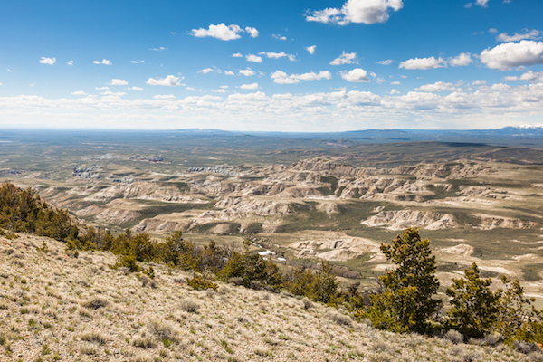
There’s no water to fish here, but a scramble to any hilltop provides stunning views of a desert-like plains to the south, Boysen Reservoir and the Absaroka Range to the west.

Copper Mountain offers a wealth of geologic and cultural resources, and challenging terrain for hikers and backpackers. There are rockfaces to climb and deep gullies rumored to hide ancient cedars. Garrett complains there’s too many mountain lions and rattlesnakes to his liking in this dry sagebrush- and juniper-covered landscape. But it provides critical refuge for the deer and elk that move into the northern and eastern parts of Copper Mountain to survive especially harsh winters, earning a portion of the WSA critical winter range habitat protections.

It’s all of these qualities, after all, that earned Copper Mountain the designation of Wilderness Study Area decades ago. This is a place that is remarkably untouched and wild. There are no roads. Anyone is free to come here and enjoy a sense of solitude — by foot or by hoof. It’s the landscape people think of when they imagine Wyoming. But the Herbsts fear these qualities may one day be lost.

There’s a lot for people to enjoy on Copper Mountain where the BLM Wilderness Study Area spans 6,858 acres of hilly, rocky terrain wedged between the Wind River Canyon to the west and the rest of Copper Mountain to the east, nestled at the southwestern edge of the Bighorn Mountain Range. On a horseback tour of the area in June, Garrett Herbst and his father Tom Herbst spotted tepee rings and mountain bluebirds darting over steep slopes speckled with budding Indian Paintbrush. (photo: Dustin Bleizeffer)

So far, the Fremont County Public Lands Committee still implicitly includes the “bottom-third” portion of the Copper Mountain WSA — just 2,000 roadless acres among 2.1 million BLM acres across the larger north-central portion of the state — in its recommendation for a motorized use study. Garrett, his father Tom Herbst, and many other locals worry that recommending such a study may be interpreted as a mandate to accommodate off-road vehicles — ATVs and even “rock crawlers” specifically designed to maw and mount rocky crags and other rugged but sensitive terrain.

While riding horseback through the “bottom-third,” Tom Herbst noted that the reason there are no roads here is because the terrain is too hilly and the soils are too delicate. A track carved by motorized wheels — even a groomed trail — would cause erosion, likely leading to another route that encourages even more erosion.

The Herbsts’ grazing allotment is situated on the northern end of the Copper Mountain WSA, which comes with the WSA-wide restriction of no motorized use. For four generations, they’ve packed in salt for wintering horses and summer cattle, and they’ve packed in materials to maintain fences and to coax spare mountain spring watering holes. That’s how it’s been done for generations — even before the WSA guidelines were established decades ago.

Opening the area to off-road vehicles would damage every quality that earned Copper Mountain its wilderness study designation in the first place, the Herbsts say. They want the Copper Mountain WSA to be excluded from any recommendation for an ORV suitability study, and they’ve gathered more than 200 signatures from others — mostly locals — who agree.

Copper Mountain grazers like the Herbsts don’t want to see the roadless area opened to motorized use. For generations, the family has packed in salt for wintering horses and summer cattle, because the landscape isn’t suited for motorized vehicles. (photo: Dustin Bleizeffer)

“It’s not good for hunters, not good for hikers, not good for wildlife. It’s only good for the ORV user,” Tom Herbst said. “Here’s the other thing for ranchers: conservation is critical in an arid area like this. If we don’t kind of conserve it, we don’t have grazing. We’ve got to take care of it.”

As Garrett and Tom find allies among the ranching community and initiate conversations to elevate suitable recreation opportunities at Copper Mountain — such as climbing, birding, and hiking — they feel the Fremont County advisory committee hasn’t taken their wishes, concerns, and local knowledge into account.

Are public lands committees listening to the public?

The Wyoming Public Lands Initiative set out to resolve the temporary status of WSAs — in limbo for nearly three decades. Each county with a WSA was encouraged but not required to participate. The initiative recognized that a consensus set of recommendations created by a broad coalition of stakeholders stands the best chance of support for congressional legislation.

WPLI’s charter states that “County WPLI Advisory Committees will be expected to encompass a broad cross-section of public lands stakeholders.” The initiative’s Principles and Guidelines state that Public Lands Committees “allow for public comment opportunities at all of the committee’s meetings” — a charge that participating committees have honored; most provided multiple opportunities, and even online comment submissions.

But the guidelines do not say how public comments are to be considered by the committees, or integrated into the committees’ final recommendations.

Neil Long is a climber who lives in Casper in neighboring Natrona County. He’s among many local climbers who frequently scale granite walls inside the four WSAs that comprise the Sweetwater Rocks complex far south of Copper Mountain. Neil and many of his fellow climbers have read through committee meeting minutes and reached out to members of the Fremont County Public Lands Committee to share their input. Neil shares the same concern as the Copper Mountain ranchers — that the committee appears to listen, but then doesn’t seem to incorporate broad public agreement into its decisions.

“I reached out and got responses ranging from no response and neutral response, and that public opinion isn’t going to persuade some [committee] members,” Neil said.

Like the Herbsts, Todd Humphreys works a grazing allotment in the Copper Mountain WSA, carrying on a 90 year family tradition. In that time there have been dustups about land use, he said, but things have worked nicely the past few decades among local ranchers, the Bureau of Land Management, and the public under the WSA designation. Humphreys says he shares the view that ranchers need to be partners with land managers and the general public that wants to enjoy the wild, roadless area.

“We have to learn how to share this,” Humphreys said. “Other people need to enjoy this too — the people who appreciate it.”

Copper Mountain grazer Tom Herbst said his family and the general public have benefited from the “wilderness” protections applied to the area for the past three decades. “I think the benefit of wilderness is it creates more respect for the land,” he said. (photo: Dustin Bleizeffer)

Humphreys acknowledged public land grazers sometimes butt heads with the BLM in some areas, but it’s working out on Copper Mountain. “The Wilderness Study Area is no problem with us,” he said. “Even if it’s [permanently] made a wilderness area, we can work with that, and we can work with the BLM. We just don’t want motorized vehicles in there with trails and trash.”

Humphreys attended several Fremont County Public Lands Initiative committee meetings, wrote comments, and helped organize with other locals, and said he appreciates the task and the manner in which the committee has worked.

“But when it came down to recommendations for this area, it seems like they protected other [WSAs in Fremont and Natrona counties] but backed off of Copper Mountain. I think there are some interests there who are not concerned with Copper Mountain, and they blocked everything we tried to conserve.”

Two committee members refused to support the draft recommendation, in part because of concerns over the potential for motorized access to areas like Copper Mountain. But it’s unclear whether the Copper Mountain ranchers will be heard as recommendations move from committee to the county commission and perhaps to Congress.

“All 325 million people in the United States have the right to be on public ground. Now it’s just a matter of how are we going to use certain parts of it?” Garrett Herbst said. “Because certain places may be suitable for certain activities. Other places — especially like we feel about this — there’s absolutely no motorized trails. Why destroy this little piece?”

Over the next few months, committees around Wyoming will seek public input as they work to finalize sets of recommendations for this and other public landscapes. You can follow the progress here at wyomingoutdoorcouncil.org, and on our Facebook page.


NOTE:
This is the first of a 3-part series about the Wyoming Public Lands Initiative, now in its final stages of approving recommendations to send to Congress.


Story Behind the Photo: “Boar’s Tusk” by Ian Cadena

[et_pb_section fb_built=”1″ admin_label=”section” _builder_version=”3.0.47″][et_pb_row admin_label=”row” _builder_version=”3.0.48″ background_size=”initial” background_position=”top_left” background_repeat=”repeat”][et_pb_column type=”4_4″ _builder_version=”3.0.47″ parallax=”off” parallax_method=”on”][et_pb_text admin_label=”Text” _builder_version=”3.0.74″ background_size=”initial” background_position=”top_left” background_repeat=”repeat”]

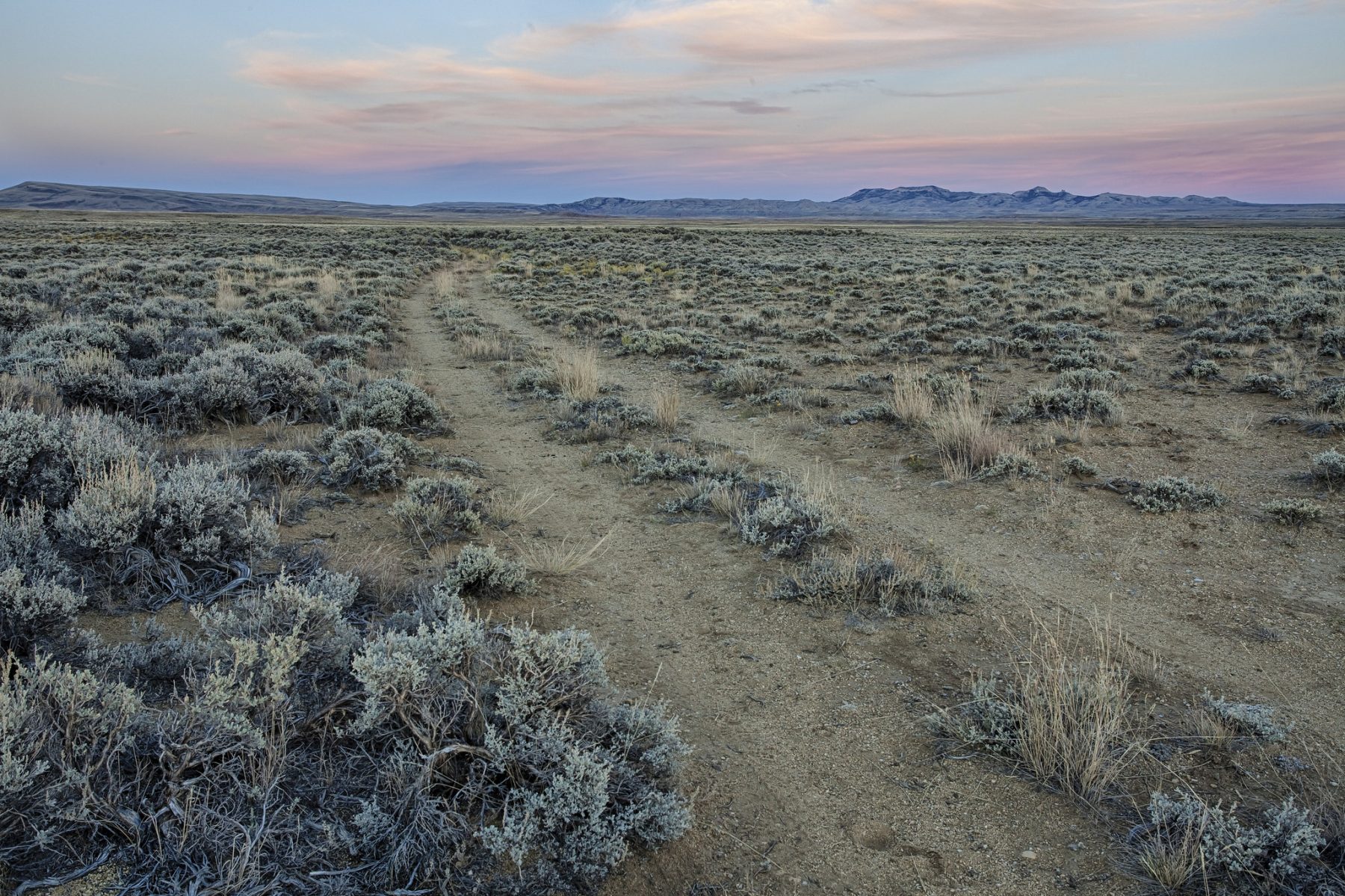
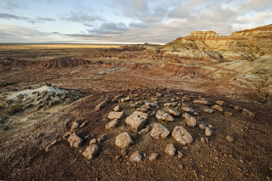
Ian Cadena’s photograph of Wyoming’s iconic Boar’s Tusk — moody, blue, and cold — portrays with authenticity the austereness of this unique high-altitude desert. When thinking of deserts, many might imagine a sea of hot, barren, sun-bathed sand. Wyoming’s Red Desert is proof of a vivid diversity, though, that many have never experienced — geologically, biologically, culturally, and historically.

This diversity provides stunning scenes, which is what Cadena found when he snapped the photo that graces February’s page of our 2018 calendar.

“It was early in the year,” he recalled of the time he decided to take a drive out to the Red Desert with his camera. At the time, it had been a place that Cadena, who lives in nearby Rock Springs used to bring his kids to partake in the quintessential summer pastime of rolling down the massive dunes that make up the Killpecker Sand Dunes complex. But on that day, it was cold and there was snow on the ground. “And there was something about the scene that day — the contrast between the snow in the background and the sand in the foreground. The solemn column of the Boar’s Tusk protruding out of the land. The snatch of birds in flight. It just seemed unreal.”

Cadena took only a few shots that day when he usually takes hundreds, he said — and one of those would be the winner, chosen as a distinct perspective of the desert that we often don’t see.

And recently, that’s become a personal mission for Cadena. Through sharing his photography on Instagram (@ianrs307), he wants to inspire people to get outside and explore, especially in Wyoming. Already, he’s had numerous people contact him to ask where all of the incredible places he photographs are. For many, he can proudly say: right in your own backyard.

“In Wyoming, we are so blessed and lucky to have everything around us that we do,” Cadena said. “You go to Colorado and all you see is private property. And it’s crowded, too. In Wyoming, you can go most places — the Winds, the Wyoming Range, the Red Desert — and not run into anyone. I tell people, ‘just get outside, get in your car, take a drive. With technology these days, you can find your way. And even if you do get lost, it’s really not a bad thing.”

Cadena’s personal story that brought him to the Red Desert and photography is strikingly similar to the Outdoor Council’s founder, the late Tom Bell. Both Cadena and Bell found a certain sense of solace in Wyoming’s wide open spaces, particularly in the Red Desert: Bell, when he returned from World War II as a decorated veteran, and Cadena, when he sought nature and photography to fill a sudden void left when he separated from his wife. Although some 50 years apart, both men reached the same conclusion after spending long, meaningful days rambling in Wyoming’s outdoors: we need to protect this for future generations.

Recently, a friend called Cadena about the image he took back that appears in the calendar. “He said that they were planning on drilling there,” Cadena said. “And all I could think was, ‘I hope not.’ And then, ‘I hope there is something we can do.’ Because while I’m all for progress, I also believe that there are certain areas that should not be disturbed. It would be such a shame to drill in such a special area.”

The contrast that Cadena captured seems fitting of the the Red Desert — where there’s a continual game of defense against pressure to development these public lands. Industrial development starkly contradicts the natural beauty and profound resources this landscape offers to myriad species of wildlife, to plant ecosystems, and to local residents and Wyoming visitors alike.

“I encourage people to get outside all the time so they can realize how much we have here in Wyoming,” Cadena said.” I keep hearing stories about the government turning land back to the state, and to see what we could possibly lose, it breaks my heart. And if we don’t do something to counter that, our kids won’t get to enjoy these things. I didn’t get into hunting, fishing and camping until I was 25, and it was an eye-opener. It was a new life. I’ll be forever grateful to my father-in-law who showed me these places, and I’ll pass this along to whoever I can. Get out and enjoy this while we can. And speak up — we have to protect what we have.”

Join Cadena and other photographers by submitting your own shot of Wyoming for the Outdoor Council’s 2019 Calendar Contest. You can enter your photos via Instagram or email. To submit your photo(s) via Instagram, you must have a public Instagram account so that we’re able to view your submission. Upload your photo(s) and add the hashtag #MyWyoming.

To submit your photo(s) via email, send your photo(s) to claire@wyomingoutdoorcouncil.org.

For more information about the contest, visit our Calendar Contest page.

.


[/et_pb_text][/et_pb_column][/et_pb_row][/et_pb_section]

Deal withdraws 24,000 acres in Wyoming Range from oil and gas drilling

[et_pb_section bb_built=”1″ _builder_version=”3.0.47″][et_pb_row _builder_version=”3.0.48″ background_size=”initial” background_position=”top_left” background_repeat=”repeat”][et_pb_column type=”3_4″][et_pb_text _builder_version=”3.10″ background_size=”initial” background_position=”top_left” background_repeat=”repeat”]

In what made for an especially happy Fourth of July, a deal was struck to protect 24,000 acres in the Wyoming Range from oil and gas drilling. This is tremendous news and gets us one step closer to realizing the collective vision behind the 2009 Wyoming Range Legacy Act: To protect the wildlife habitat and recreational opportunities in our state’s namesake mountains, today and for future generations.

Our gratitude goes out to our partners at The Trust for Public Land for negotiating and the Wyss Foundation for funding the purchase and retirement of the last remaining valid, existing oil and gas leases in the Wyoming Range. Our gratitude also extends to Gov. Matt Mead for supporting this outcome. “The Wyoming Range offers vistas, great outdoor recreation and diverse wildlife habitat,” Gov. Mead said in a statement. “The BLM worked with these companies to close out these leases and provide a good balance of development and environmental considerations.”

Here’s the backstory:

In the 1990s, Stanley Energy had already acquired oil and gas leases in the Wyoming Range (see leases in green on map). It sought to acquire additional acreage in the national forest and nominated nearby parcels. Despite public opposition, in 2005 the U.S. Forest Service consented to lease more than 40,000 acres along the eastern edge of the Wyoming Range. The BLM auctioned the leases and Stanley Energy was among the high bidding companies (see leases in orange on map).

Protests and appeals lead by the Wyoming Outdoor Council and joined by citizens, sportsmen and outfitter partners were ultimately successful. The Forest Service and BLM were instructed to go back and remedy oversights made in the initial and improper decision to lease. If the values considered on the whole caused the Forest Service to make a different decision — a no leasing decision — the contested oil and gas leases could be cancelled.

Passage of the Wyoming Range Legacy Act in 2009 made clear that the fate of these 40,000 contested acres was in the hands of the Forest Service. The agency could authorize or cancel them based on a thorough and updated analysis. If the leases were cancelled, the high bidders would get their money back — and, more importantly, because the Act prohibits future oil and gas leasing, the area would never be leased again.

After more than a decade and two environmental impact statements, the Forest Service reached a final decision in early 2017. Thankfully, it was the right decision — one we worked hard to secure, and one we celebrated with our members and partners. The roughly 40,000 acres of contested leases would be cancelled and high bidders would be refunded their money.

Because the BLM cannot legally authorize oil and gas leases over the objection of the Forest Service when mineral leases underlie national forest land, the BLM is obligated to issue cancellation letters and refunds to the high bidders. In exchange for accepting the BLM’s decision to cancel the leases and refund the money Stanley Energy spent to bid on the 21,000 acres of contested oil and gas leases (orange), an offer was made that its 24,000 acres of valid, existing oil and gas leases (green) would be purchased.

Thanks to The Trust for Public Land’s work and the generosity of the Wyss Foundation, another 45,000 acres in the Wyoming Range will be forever protected for its wildlife habitat and recreational opportunities. We couldn’t be more grateful.


[/et_pb_text][/et_pb_column][et_pb_column type=”1_4″][et_pb_image src=”https://wyomingoutdoorcouncil.org/wp-content/uploads/2018/07/Wyoming-Range-lease-Map.1.jpg” show_in_lightbox=”on” _builder_version=”3.10″]


[/et_pb_image][et_pb_blurb _builder_version=”3.10″]

This map (click to enlargedepicts more than 10 years of efforts to retire and remove oil and gas lease parcels from the Wyoming Range, where a broad coalition of citizens sought to protect the area for its unique wildlife and recreational opportunities. (Map created by the Wyoming Outdoor Council.) 

[/et_pb_blurb][/et_pb_column][/et_pb_row][/et_pb_section]

Oil and gas lease sales threaten Wyoming’s Red Desert

[et_pb_section bb_built=”1″ _builder_version=”3.0.47″][et_pb_row _builder_version=”3.0.48″ background_size=”initial” background_position=”top_left” background_repeat=”repeat”][et_pb_column type=”3_4″][et_pb_text _builder_version=”3.10″]

[Updated July 24, 2018] We need your help to protect the heart of Wyoming’s wild public lands — the Red Desert! In Wyoming’s most recent state lands oil and gas lease sale, 21 parcels located in the fragile, beautiful Red Desert received bids, and are now under threat of development. The final decision to move forward with these lease purchases will be made by the State Board of Land Commissioners — comprised of Wyoming’s top elected officials, including Governor Matt Mead — on August 9. If oil and gas development is allowed on these 21 parcels, countless invaluable resources will be harmed, including crucial winter habitat for big game, historic pioneer trails, stunning volcanic rock formations, North America’s largest sand dune complex and dozens of other historic, cultural and natural resources.

The state oil and gas lease parcels that dot the Red Desert map, if authorized, would allow for industrial development that could forever harm the entire landscape at an incalculable cost to Wyoming’s wildlife, cultural heritage and outdoor recreation economies. The July state lease sale precedes two federal oil and gas lease sales in September and December that also include parcels in sensitive areas, such as the Red Desert-to-Hoback big game migration corridor. This means the state, if it moves forward with authorization, will only multiply the threat posed by the Trump administration’s “energy dominance” mandate for public landscapes in Wyoming.

“The leasing of these stranded state land parcels for oil and gas development is a scenario for future management conflicts,” Wyoming Outdoor Council Executive Director Lisa McGee stated in a letter to Gov. Matt Mead. “This is because some of these areas are so fragile, pristine or so easily disrupted, that a single well could significantly erode the integrity of the landscape or resource. Many of the state land parcels have no road or pipeline access — creating threats of future impacts where none exist today.”

A broad coalition of stakeholders, including Native American communities and sportsmen, is asking the Wyoming State Board of Land Commissioners to withdraw the 21 lease parcels and allow for a more measured approach to leasing in the Red Desert.

Stakeholders are mindful that Wyoming’s constitution prioritizes uses of state lands to generate revenue for Wyoming schools. The mandate can be better met without auctioning these mineral lease parcels, and instead working to exchange them for BLM parcels more suited to industrial development.

Read the Wyoming Outdoor Council’s June 2018 letter to Gov. Matt Mead.

Review our Fact Sheet for talking points and more background about the Red Desert and current leasing threats.

Join us in asking the Office of State Lands and Investments and the Wyoming State Board of Land Commissioners to withdraw the 21 state oil and gas lease parcels for sale in Wyoming’s Red Desert this month. Call or write an email, and let them know your connection to these special Wyoming places, and why you want to protect them for future generations.

To submit a comment to all five commissioners at once, go to our comment portal. Or you can submit comments to the individual commissioners:

Bridget Hill, Director, Office of State Lands and Investments
307.777.6629
bridget.hill1@wyo.gov

Matt Mead, Wyoming Governor
307.777.7434
Fill out email form

Edward Buchanan, Secretary of State
307.777.7378
SecOfState@wyo.gov

Cynthia Cloud, State Auditor
307.777.7831
SAOAdmin@wyo.gov

Mark Gordon, State Treasurer
307.777.7408
treasurer@wyo.gov

Jillian Balow, Superintendent of Public Instruction
307.777.7675
superintendent@wyo.gov


[/et_pb_text][/et_pb_column][et_pb_column type=”1_4″][et_pb_image src=”https://wyomingoutdoorcouncil.org/wp-content/uploads/2018/07/NRD4.jpg” show_in_lightbox=”on” _builder_version=”3.10.2″]


[/et_pb_image][et_pb_blurb _builder_version=”3.10.2″]

This map (click to enlarge) depicts the coverage of the state oil and gas lease sale parcels we’re asking to be withdrawn.

[/et_pb_blurb][/et_pb_column][/et_pb_row][/et_pb_section]

Last chance to comment on important Fremont and Natrona County public lands

[et_pb_section bb_built=”1″][et_pb_row][et_pb_column type=”4_4″][et_pb_text _builder_version=”3.7″]

Since June 2016, a group of Fremont and Natrona County citizens​ have met to negotiate the future of the eight Wilderness Study Areas (WSAs) and other lands in the two counties. As part of the Wyoming Public Lands Initiative, these nine volunteers represent interests from agriculture, energy, recreation (both motorized and non-motorized), conservation, county commissions, sportsmen, and the general public. The management recommendations they make will be passed to the Fremont and Natrona County Commissions before inclusion in a public lands bill. This final bill will be a package sponsored by Senator Barrasso at the Congressional level and will include other recommendations from other county-level initiatives taking place around the state.

Now is your last chance to weigh in as a local on the fate of these important public lands. This is your last chance to ask for strong conservation protections for Sweetwater Rocks, the Sweetwater Canyon, the Dubois Badlands, Whiskey Mountain, Copper Mountain, and the Lander Front.

To share comments with the committee, you have two options (and we encourage you to do both!):

  1. Submit written comments to fcpli.comments@gmail.com by 5 p.m. on Thursday, June 21.
  2. Attend the final advisory committee meeting on Thursday, June 28 – the last meeting before the group forwards their recommendations to the Fremont County commission.

[/et_pb_text][et_pb_blurb admin_label=”Meeting Info” _builder_version=”3.7″ header_text_align=”center” body_text_align=”center” module_alignment=”center” background_color=”#fcaf17″ text_orientation=”center” header_level=”h2″ header_font=”|||on|||||” header_text_color=”#160000″ header_font_size=”20″ header_line_height=”2em” body_font_size=”20″ image_max_width=”50%” max_width=”50%” body_text_color=”#160000″ custom_margin=”5px|5px|5px|5px” custom_padding=”5px|5px|5px|5px” body_line_height=”1.5em” box_shadow_style=”preset2″]

THURSDAY, JUNE 28
6 p.m.
Fremont County Courthouse
Commissioners’ Chambers
450 N. 2nd St. #200

Lander, WY 82520

[/et_pb_blurb][et_pb_text _builder_version=”3.7″ header_3_font=”|||on|||||” header_3_text_color=”#007ea9″]


What are the draft recommendations?
What should be improved?

For a brief review of the recommendations thus far, check out these simple guides to the committee’s draft package and what crucial conservation improvements we suggest you can include in your comments.

We want to encourage the committee to prioritize the unique values of these landscapes and call for the protection of the rugged, backcountry qualities of places like the Dubois Badlands and Sweetwater Rocks. Assigning those areas special designations such as wilderness or National Conservation Area will ensure they are managed in the future just as they are today. We’d also like the committee to explicitly prohibit mineral extraction in important areas such as Whiskey Mountain and on the Lander Front, and to ban the creation of new roads on landscapes that are currently Wilderness Study Areas. The committee has recommended that about 6,000 acres of the Sweetwater Canyon Wilderness Study Area be designated as wilderness — we suggest that you support wilderness on the Sweetwater Canyon in your comments.

The Fremont advisory committee is also recommending that the Bureau of Land Management look for appropriate places to add new motorized recreation trails, and we want to make sure that areas like Copper Mountain aren’t considered for that kind of development. However, we do want the committee to strongly suggest that public access to public lands is protected and improved as a part of this recommendation package.

How do I make a strong comment?

Get to the point, but also personalize your perspective. Speak about how these specific landscapes are important to you and how they keep you living and working in Wyoming. Be specific about the management you support for these landscapes, and highlight any recommendations or possible changes that you can’t get behind.

In the last few weeks, it’s been heartening to connect with so many powerful conservation voices around Wyoming as we work to inform stakeholders about the details of this recommendation package. Conservation advocates in Lander, Dubois, and Casper have been working together — and together, we can make our voices heard and ensure that our treasured public lands remain wild and protected long into the future. I hope to see many of you in Lander next Thursday! And please, email me if you have any questions.

[/et_pb_text][/et_pb_column][/et_pb_row][/et_pb_section]

Running the Red Desert for conservation

[et_pb_section bb_built=”1″][et_pb_row][et_pb_column type=”4_4″][et_pb_text _builder_version=”3.7″]

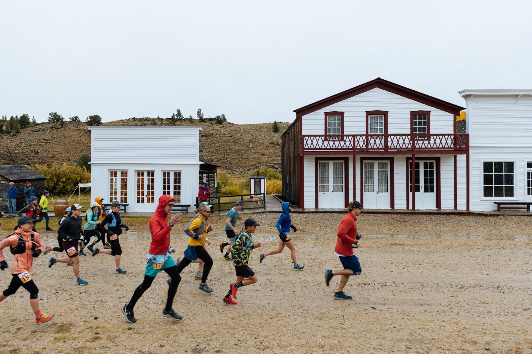
“I’ve always been attracted to the Boar’s Tusk,” Wyoming Outdoor Council member Daniel Dale said after finishing a challenging 23-kilometer run that took him past the iconic Red Desert landmark. “Now I have a personal story to go with it.”

Fostering personal connections to this stunning — and threatened — landscape is what Run the Red is all about. The sandy, hilly terrain draws athletes eager for a challenge. Since its creation five years ago by the Outdoor Council and partners from NOLS and the Wyoming Wilderness Association, the race’s primary goal has been to help people create their own stories about this unique place, so they might better advocate its protection.

The Red Desert needs as many advocates as it can get. As oil and gas leases are fast-tracked on public lands under a new “energy dominance” mandate, the fate of this rugged, wild landscape hangs in the balance.

Right now, the Bureau of Land Management is revising its land-use plan for much of the desert. That plan will determine how multiple activities — including energy development — are balanced with conservation for the next 15 to 20 years. Some of the BLM’s proposed activities could limit public access and threaten important wildlife habitat in the desert.

And in a particularly troubling move, the BLM has proposed offering oil and gas lease parcels inside the one-of-a-kind Red Desert to Hoback mule deer migration corridor — the longest mule deer migration ever recorded, and a lifeline for deer populations as well as a wealth of other Wyoming species.

“The Red Desert to Hoback mule deer migration is a unique feature of this landscape,” WOC conservation advocate Kristen Gunther told Run the Red participants on June 2. “If oil and gas operators are allowed to drill inside the narrow corridor that these animals depend upon for survival, our ability to maintain healthy mule deer numbers in Wyoming will be severely threatened.”

This year, runners wrote postcards to Governor Matt Mead requesting that he ask the Interior Department to defer oil and gas leasing in the migration corridor. Dozens of postcards were collected at the finish line, filled with fresh stories of people’s newfound love and appreciation for the Red Desert, its beauty, and its ecological, cultural, and historical significance. These messages will be forwarded to the governor and other state elected officials.

For more information about how you can help advocate for the Red Desert, visit runthereddesert.com.

[/et_pb_text][/et_pb_column][/et_pb_row][et_pb_row][et_pb_column type=”1_2″][et_pb_image _builder_version=”3.6″ src=”https://wyomingoutdoorcouncil.org/wp-content/uploads/2018/06/IMG_1843.jpg” url_new_window=”on” /][et_pb_image _builder_version=”3.6″ src=”https://wyomingoutdoorcouncil.org/wp-content/uploads/2018/06/IMG_7575.jpg” /][/et_pb_column][et_pb_column type=”1_2″][et_pb_image _builder_version=”3.6″ src=”https://wyomingoutdoorcouncil.org/wp-content/uploads/2018/06/IMG_2749.jpg” /][et_pb_image _builder_version=”3.6″ src=”https://wyomingoutdoorcouncil.org/wp-content/uploads/2018/06/IMG_1959.jpg” /][/et_pb_column][/et_pb_row][et_pb_row][et_pb_column type=”4_4″][et_pb_blurb admin_label=”Race Results” _builder_version=”3.6″ title=”Run the Red 2018 Race Results” text_orientation=”center” header_text_align=”center” header_level=”h3″ header_font=”|700||on|||||” border_radii=”on|1px|1px|1px|1px” border_color_all=”#fcaf17″ border_width_all=”2px” box_shadow_style=”preset2″ header_line_height=”2em” background_color=”#fcaf17″ header_text_color=”#007ea9″]

Scott Pies, from Rock Springs, came in first place in the 50K with a time of 04:00:02. Erik Aanerud, also from Rock Springs, won the 23k with a time of 01:00:55, and John Raymond, from Farson, came in first in the 5K with a time of 00:26:29. (For complete results, visit ultrasignup.com and search “Run the Red.”)

[/et_pb_blurb][/et_pb_column][/et_pb_row][/et_pb_section]

Land Grab in Sheep’s Clothing

[et_pb_section bb_built=”1″][et_pb_row][et_pb_column type=”4_4″][et_pb_text _builder_version=”3.0.98″ background_layout=”light”]

This month, Sen. John Barrasso introduced, and Sen. Mike Enzi co-sponsored, a reckless measure to advance the Trump administration’s disastrous doctrine of “energy dominance” over all other uses on public lands.

The “Opportunities for the Nation and States to Harness Onshore Resources for Energy Act,” or the ONSHORE Act (S. 2319), hands federal oil and gas drilling permit authority and duties to individual states. Sen. Barrasso claims this is a remedy to “punishing regulation and permitting delays” for oil and gas development on federal lands. Yet the legislation’s supposed remedy actually raises more questions than it answers.

The language of the bill is so vague that it’s unclear whether the states that choose to take on issuing federal permits to drill will also conduct the normal federal review and public comment process that all Americans have been afforded for decades.

Far from providing more certainty and faster permitting, if the ONSHORE Act is implemented states would have to dig deep into their budgets to hire new staff to take on the additional workload. It’s also unclear whether a state would accept new legal and environmental cleanup liabilities that usually belong to the federal government.

Federal permitting is not the problem. The challenge is in managing large and complex development projects. The remedy for that is to provide federal agencies with the expert staff and resources required to carry out the duties that reflect American values for our public lands.

Polling consistently shows that Americans favor protecting our public lands for wildlife and recreation over energy development. Instead of reflecting these values, the ONSHORE Act looks like part of the Trump administration’s plan for energy dominance over all other uses on public lands.

Rep. Liz Cheney introduced an even worse version of the ONSHORE Act in October. Development proposals ought to be considered as efficiently as possible, and not expedited at the cost of public input and thorough review. The Outdoor Council believes that our congressional delegates would serve Wyoming’s interest best by supporting adequate funding and autonomy to federal agencies that are legally bound to manage public lands in the interest of all Americans, and in coordination with local input.

Far from perfect, Wyoming can be confident of its own agencies’ abilities to manage oil and gas activities that fall under state authority. Wyoming can do its best in managing these activities when it can work with federal counterparts that are adequately funded and not interfered with by a top-down approach to resource management.


[/et_pb_text][et_pb_button _builder_version=”3.0.98″ button_text=”Email the Senators” button_url=”http://www.congressweb.com/WYOC/36″ url_new_window=”on” button_alignment=”center” background_layout=”light” custom_button=”off” button_icon_placement=”right” /][/et_pb_column][/et_pb_row][/et_pb_section]