THE ENDURING DAMAGE OF RADIOACTIVE WASTE ON THE WIND RIVER RESERVATION

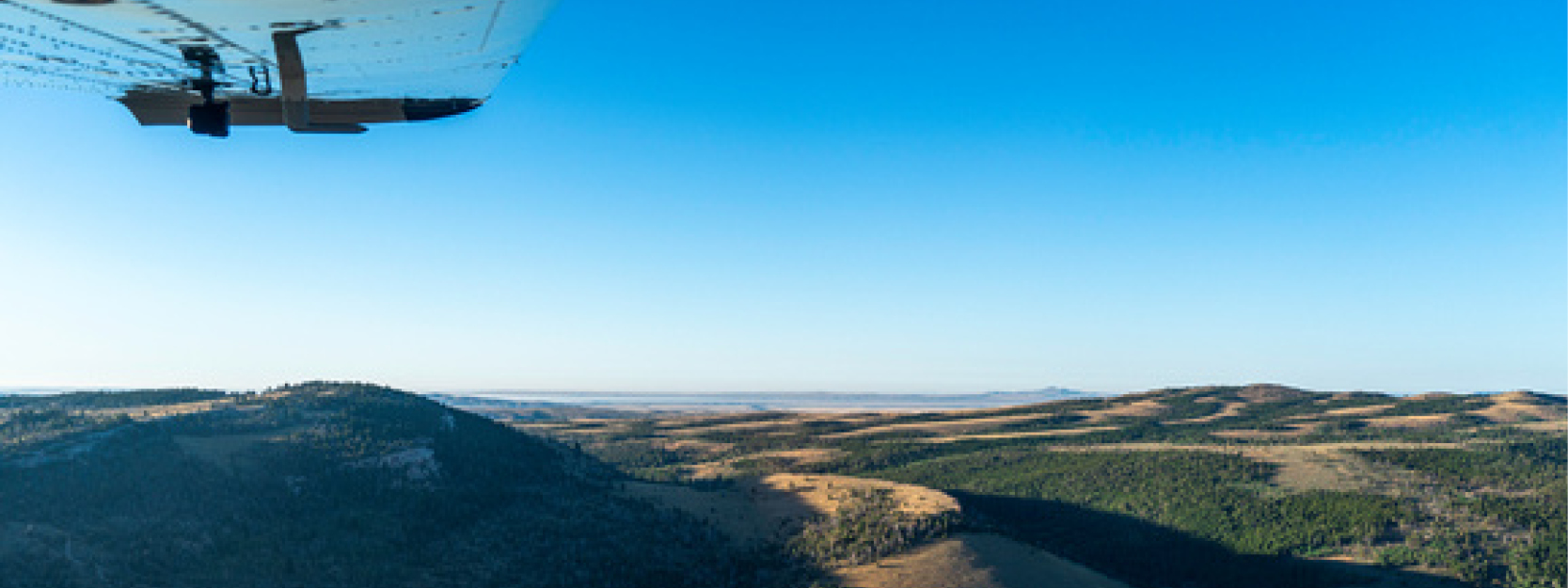
In Wyoming and across the U.S., tribes and tribal lands bear scars from the country’s nuclear programs. From abandoned radioactive waste to land seizures to the cancer-causing debris of weapons testing, tribal communities have been disproportionately impacted by nuclear development and its lasting consequences. Unfortunately, in the critical discussions surrounding nuclear projects, the voices of nearby tribal communities have often been sidelined or altogether ignored.

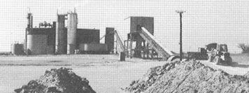
The Susquehanna-Western uranium mill, near Wyoming’s Gas Hills, was established during the mid-century uranium boom on tribal lands sold under duress. When it closed in 1963, nearly 1.8 million cubic yards of radioactive waste were left behind — and the Northern Arapaho and Eastern Shoshone Tribes are still dealing with the consequences.

Now, as the discussion around storing the nation’s high-level radioactive waste in Wyoming heats up, it’s more important than ever to learn from Susquehanna and other historical and ongoing injustices.

Below, Big Wind Carpenter and Jennifer Fienhold, WOC’s tribal conservation advocates, detail the fallout from the Susquehanna mill. They also share how, despite marginalization of tribal voices, advocates continue to demand justice for their communities and their land. As Jennifer puts it, “You will never read about the tribes being the unsung heroes of these tales, which is the biggest injustice of all.”

Big Wind Carpenter: A uranium mill’s toxic legacy

For many, the uranium boom of the 1950s was a sign of progress for the country, but for the people of Arapahoe, it resulted in a toxic legacy. When uranium mining began in the Gas Hills, a local milling site was required to process the uranium ore. The land chosen for the mill site was on the Wind River Reservation and belonged to members of my family. The Bureau of Indian Affairs came to our families to buy the land for the federally funded project. When they refused, BIA coerced some into signing documents, promising payments that never arrived. Those who resisted were threatened with arrest and forced off their own land. The mill site was then constructed and operational within a year’s time.

Although the project was brief, its impact lingers today. The Susquehanna plant operated for only five years before closing, but when it shut down, it left behind a 70-acre unlined impoundment of tailings — approximately 1.8 million cubic yards of low-level radioactive waste.

The Department of Energy removed the tailings in the late 1980s, claiming the danger was eliminated. This was a false promise. Over time, rain and snowmelt washed radioactive materials deep into the ground, polluting the water supply. This created an underground uranium plume — a silent threat that continues to grow, expanding from 20 to 27 acres in recent years and inching closer to the Big Wind River. This experience has left a deep scar on our community. We have seen loved ones suffer and even lose their lives from illnesses linked to radiation exposure from using tainted well water.

Excerpted from a January 20, 2025 post on the WOC blog. Read the full post here.

Jennifer Fienhold: The story’s unsung tribal heroes

You can find a full Department of Energy report detailing the remedial efforts around the Chemtrade mill (formerly the Susquehanna mill) online. However, what you will not find in this report is the fight brought to the federal government, the Department of Energy, and the Environmental Protection Agency by the tribes.

Both the Northern Arapaho and Eastern Shoshone Tribes monitored the impacts of this waste. After years of the surrounding community of Arapahoe being exposed, cancer levels began to rise. These consequences could also be seen in local wildlife, which began to show telling signs of radioactive exposure, but perhaps what was most alarming, a plume had formed under the plant and contaminated the local water sources. It would take an eight-year battle, diligence, and advocacy for basic human rights, but in 1988, the Tribes finally made headway. The Department of Environmental Quality alongside the EPA were forced to initiate remedial efforts to assist in addressing the long-standing contamination taking place as a result of negligent handling of nuclear waste.

In the end, it was decided to move the waste to Gas Hills, the original location of the uranium mining. The rationale behind this decision: take it back to where it came from. However, there had been other conversations. Within the same remedial report was also the proposal for other sites, 18 of them. Of these, three were seriously considered, and one was on the reservation.

Even two warring tribes, who could be found in tumultuous disagreements in the best of times, united to send the clear message that they did not want radioactive and nuclear waste stored on their lands, and made it clear they were not to continue to be tasked with environmental consequences that had already been forced upon them.

Excerpted from an unpublished account of Jennifer’s recent trip to Yucca Mountain, Nevada. Yucca Mountain was once the proposed repository for the nation’s nuclear waste, until the Western Shoshone, whose treaty land includes the site, successfully opposed the project. Stay tuned for the full account.

Image: A Susquehanna-Western uranium mill in Karnes County, Texas.

Q&A: An Eagle-Eye View of the Red Desert

In Wyoming’s Red Desert, the necessity of truly big-picture, holistic thinking around conservation advocacy is on full display. For one, it’s home to big game herds that require intact habitat throughout the length of migration corridors that span hundreds of miles. For another, it’s a place that has been stewarded by people for millennia, whose descendents are still here — and whose voices are critical for any conversations about how this land should be managed.

While obstacles to this kind of big-picture thinking are many, the sheer scale of the landscape presents a unique challenge: At more than a half-million acres, how do you wrap your mind around an area the size of the Red Desert?

Recently, Tribal Engagement Coordinator Big Wind Carpenter worked with EcoFlight, a Colorado-based organization, to share a bigger-picture perspective of the desert … from high above, in a small 6-seater propeller plane!

During the flights, Big Wind narrated a loop over the Red Desert for Eastern Shoshone and Northern Arapaho elders, pointing out many of the cultural resources that hold special significance for more than a dozen Tribes with connections to the land. We sat down with Big Wind to hear about their work with EcoFlight and to learn what insights might be gained from taking to the skies.

[Interview edited for length and clarity.]

Images: EcoFlight

You’ve been sharing the values of the Red Desert with others for years now, but primarily with vehicle tours. How does EcoFlight fit into the work you’ve been doing there?

You could spend your entire life exploring the Red Desert — it’s that big of a landscape. When we leave Lander on a vehicle tour, whether we’re taking elected officials, Tribal people, WOC members, or donors, we know that it’s going to be an all-day trip, because a lot of these areas have long distances between them.

For people who don’t have that time or that mobility, I think it’s important that we try to work out a different tour for them. The intention for this year’s flight was to get some Tribal elders out there. We were able to get Reba Teran, an Eastern Shoshone elder and language teacher, and Mary Headley, a Northern Arapaho elder who teaches at the Arapaho Immersion School, to join us. And then they also brought their helpers with them because they have mobility issues. We’re trying to make sure that people who have mobility issues are still able to see these places, and have these discussions.

Tell us a little about your flight path — which parts of the Red Desert did you get to see?

We did two flights that morning, and we kind of did a loop of everything north of I-80. We left the Lander airport early that morning, flew over Red Canyon, flew to where the Great Divide Basin starts over by the Oregon Buttes and the Honeycomb Buttes. Then we moved down to the Killpecker Sand Dunes and Boar’s Tusk. From there, we flew over the White Mountain petroglyphs, checked out Steamboat Mountain, and came back up through the Wind River Range.

For someone like you, who has spent so much time out in the Red Desert, what’s it like to see it from the air?

I think the Red Desert is such a special place, because it has all of these different microhabitats within the area that it covers. You have the south side of the Winds, and the sand dunes, and areas of sagebrush. The plains, the desert, and the mountains meet in this area, but you don’t understand completely until you’re thousands of feet above it. I think the EcoFlight is a very powerful tool to be able to visualize how interconnected these habitats are to one another. It’s such a beautiful thing.

Could you share some of the highlights of the flight?

Being able to see the sand dunes moving in real time was a highlight. The Killpecker Sand Dunes are the largest living sand dune field in North America. When you’re on the ground, there’s always a steady wind, and you can kind of see the sand moving. But when you have a bird’s eye, you can actually see where they’re traveling across the landscape.

Also, there were also some pretty good migrations of antelope coming down off the mountains. Especially knowing how diminished those populations are after last winter, it was amazing to see just how resilient these animals are to be migrating across the land.

What was it like to share an aerial view of the Red Desert with the elders who joined you? And with other, younger Tribal members?

For both Reba and Mary, especially as culture and language teachers, I think it was important for them to be able to tell us the names of these places, and what those names meant, and why they were named a certain way. As an Arapaho person myself, being in a situation where Mary was educating other Arapahos who didn’t know those areas was really impactful. I have Shoshone family (although I’m not a Shoshone Tribal member), so being out there with Reba and hearing their stories, hearing their names, and why they’re named those things felt very impactful to me, too.

Over a dozen Tribes have relations with that landscape: The Shoshone, the Crow, the Cheyenne, and many others have stories about that land and their connection to that landscape. Some of those Tribes, their stories go back thousands of years. So I think it’s really important that not only are those stories told, but that those stories are shared with the next generation. Not only did we have the elders, but we had young people on both of those flights who were able to hear from the elders, and I think that made this very significant.

I think that’s interesting, because you’re in a role where you’re the tour guide. But you’re also learning from your elders, too.

Yeah. I think that’s a part of our culture, as Indigenous people. We look to our elders for guidance, we look to our elders to be able to tell stories. There’s places like the Birthing Rock, and the White Mountain petroglyphs, and all these other sacred sites that are found in the Red Desert. If we don’t relay this information, it will be lost. So it’s important to ensure that our elders are able to have the space to pass on these stories to young people.