 View of Adobe Town from Skull Creek Rim, photo by Chris Merrill
By Bruce Pendery

I’m writing today about the latest in what has been a flurry of Bureau of Land Management land-use plan revisions and amendments—this one, the proposed changes to the Rawlins-area resource management plan.
I’ll start with the bad news: this amendment, as written, needs a lot of work. It has major, and multiple, flaws. The good news is our collective input can help make it better.
The BLM is currently taking comments—which are due October 28—on its proposed modifications to this land-use plan.
And a quick email from you can help ensure that some important changes are made before the amendment is final.
If you only have time to write one paragraph, please do just that!
See the bullets below for some suggestions on what you might write to the agency.
You can click here to send an email right now.
Why this amendment matters
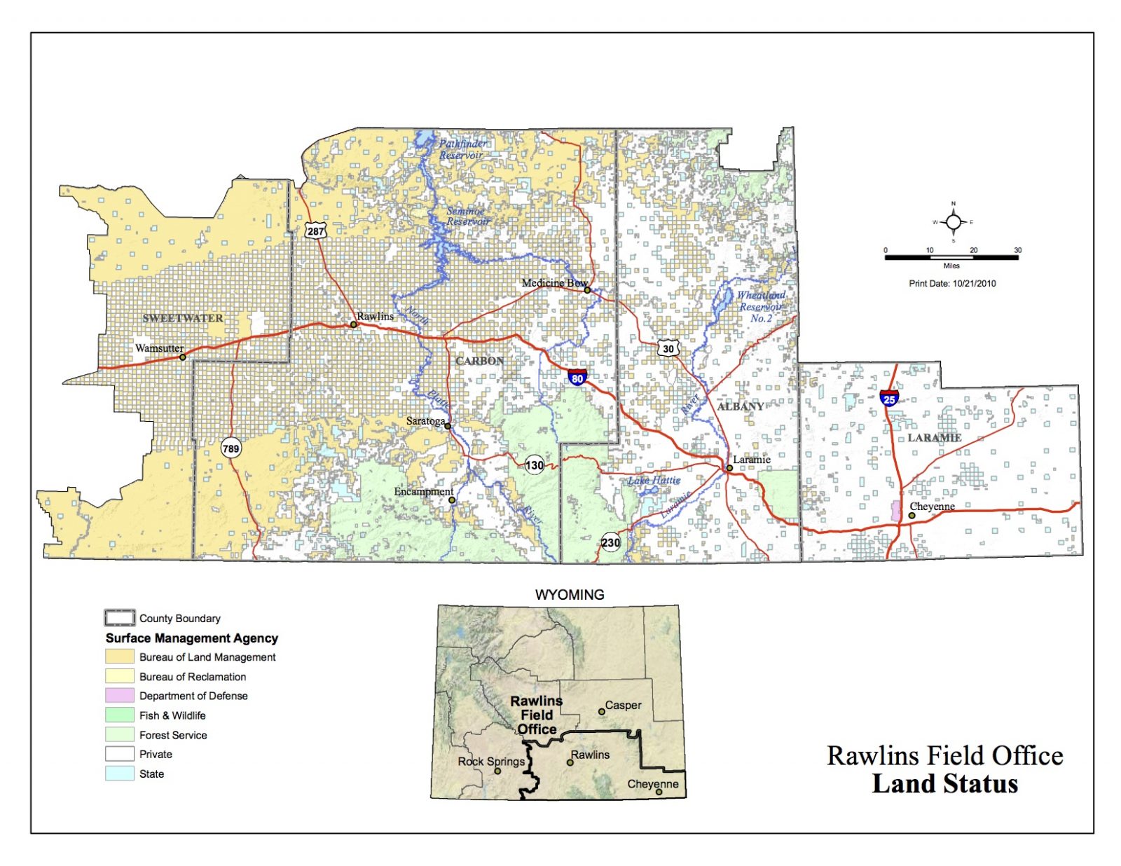
As you can see on the map above, this land-use plan covers a huge expanse of real estate, spanning more than 5,400 square miles, and it includes much of southern Wyoming.
The proposed amendment to this land-use plan deals with two issues: (1) designations of what the agency calls, “visual resource management classes” throughout the Rawlins planning area, and (2) designations of what it calls “areas of critical environmental concern.”
The visual resource designations have the potential to greatly advance—or set back—the environmental protections on these public lands. So your comments are critical.
From our perspective, the BLM’s proposed amendment is woefully inadequate.
It would give 57 percent of the landscapes under consideration the lowest level visual resource protection (what the agency calls “visual resource management Class IV”).
Within these so-called “VRM Class IV” areas, projects can be allowed to cause “major modifications” to the existing character of the landscape. And industrial and other activities would be allowed to “dominate” the views that you see.
 View from Adobe Town Rim, photo by Chris Merrill
While this proposed amendment would provide slightly improved protections in the iconic Adobe Town area—the area would mostly be designated “VRM Class III,” with some heightened protections in the vicinity of the wilderness study area.
Most of the Federal lands in the Laramie area would be given the lowest-level (“VRM Class IV”) designation, as would most of the lands in the beautiful, wide-open Shirley Basin.
 Shirley Basin, Wyoming, photo by Ken Driese
The proposed plan would provide for good visual resource protections in the Ferris/Shirley/Seminoe/Pedro Mountains areas, as well as in the northern Laramie Mountains, and in areas adjacent to the Medicine Bow National Forest west of Laramie.
The BLM will accept comments until October 28:
By email:
By mail:
Bureau of Land Management Rawlins Field Office
Rawlins RMP Amendment and EA
1300 North Third Street
Rawlins, WY 82301
By fax: 307-328-4224
We would suggest that you consider making one or all of the following requests to help the agency improve this plan:
- Please improve visual protections for the Adobe Town area and in the Laramie area. The provisions of alternative 3, which are specified in the agency’s environmental assessment, should be adopted instead. This would provide for VRM Class I and II designations in the Adobe Town area and there would be much more VRM Class II in the area surrounding the Medicine Bow National Forest, east of Laramie (the Vedauwoo area).
- This Vedauwoo area is one of the most cherished and well-used recreation areas in southeastern Wyoming. It is hugely important to the local economy and quality of life. If this viewshed were to be harmed by industrial development it would be a major blow to Laramie and Cheyenne’s long-term economic development.
- We believe the BLM should make VRM Class III designations within at least 5 miles of major roads. These include I-80, I-25, U.S. Highways 30 and 287, and Wyoming Routes 77, 230, 487, and 789. These areas are key thoroughfares in full view of thousands of people, and are important travel, tourist, and recreation conduits—so greater visual resource protection should be provided to help safeguard the travel, tourism, and recreation economy, which is Wyoming’s second largest industry.
- The Shirley Basin area should be designated VRM Class II. No current alternative provides for this. But this iconic area deserves greater visual resource protection than the BLM is proposing. It is a popular destination with Laramie recreationists and hunters, it is an incredible, largely undeveloped wide-open expanse of grasslands, and it provides important habitat for pronghorn, mule deer, elk, hawks, and sage-grouse, as well as a population of the critically endangered black-footed ferret. The BLM’s environmental analysis shows that some of this area has a “Class A Scenic Quality” rating and a “High visual sensitivity level.”
- There are many special places that do not receive adequate protection under the BLM’s proposed plan. These include an ACEC, Wildlife Habitat Management Areas, Special Recreation Management Areas, the Continental Divide National Scenic Trail and the Cherokee and Overland Historic Trails, National Natural Landmarks, Wild and Scenic River Eligible Segments, and crucial wildlife habitats. You could ask for improved protections for all of these areas—or any that are especially important to you personally or your local community.
Other thoughts:
- You might consider supporting the BLM’s proposed VRM classifications in the Ferris/Shirley/Seminoe/Pedro Mountains area, in the northern Laramie Mountains, and in the areas adjacent to the Medicine Bow National Forest west of Laramie. We think these are strong.
- The proposed plan would provide for an expansion of the Blowout Penstemon ACEC. We strongly support this, including the provision making this area unavailable for oil and gas leasing. While expanding the ACEC from 17,185 acres to 29,312 acres would be beneficial, the protection alternative would expand it to 49,200 acres and you might consider asking BLM to do that.
The Rawlins Field Office is immense, so getting these improved protections could benefit a great deal of public land. It stretches from west of Wamsutter all the way to the Nebraska border, and from the Colorado border north as much as 100 miles.
More information is available on the BLM Rawlins Field Office website here.
If you would like more information you can contact Bruce Pendery, Wyoming Outdoor Council, bruce@wyomingoutdoorcouncil.org or (435)-752-2111.
West Edge
Collective
Staff