Scroll down or click here for maps depicting the reclassified (downgraded) streams
By Gary Wilmot, executive director
This article originally ran as an Op-Ed in the Jackson Hole News & Guide.
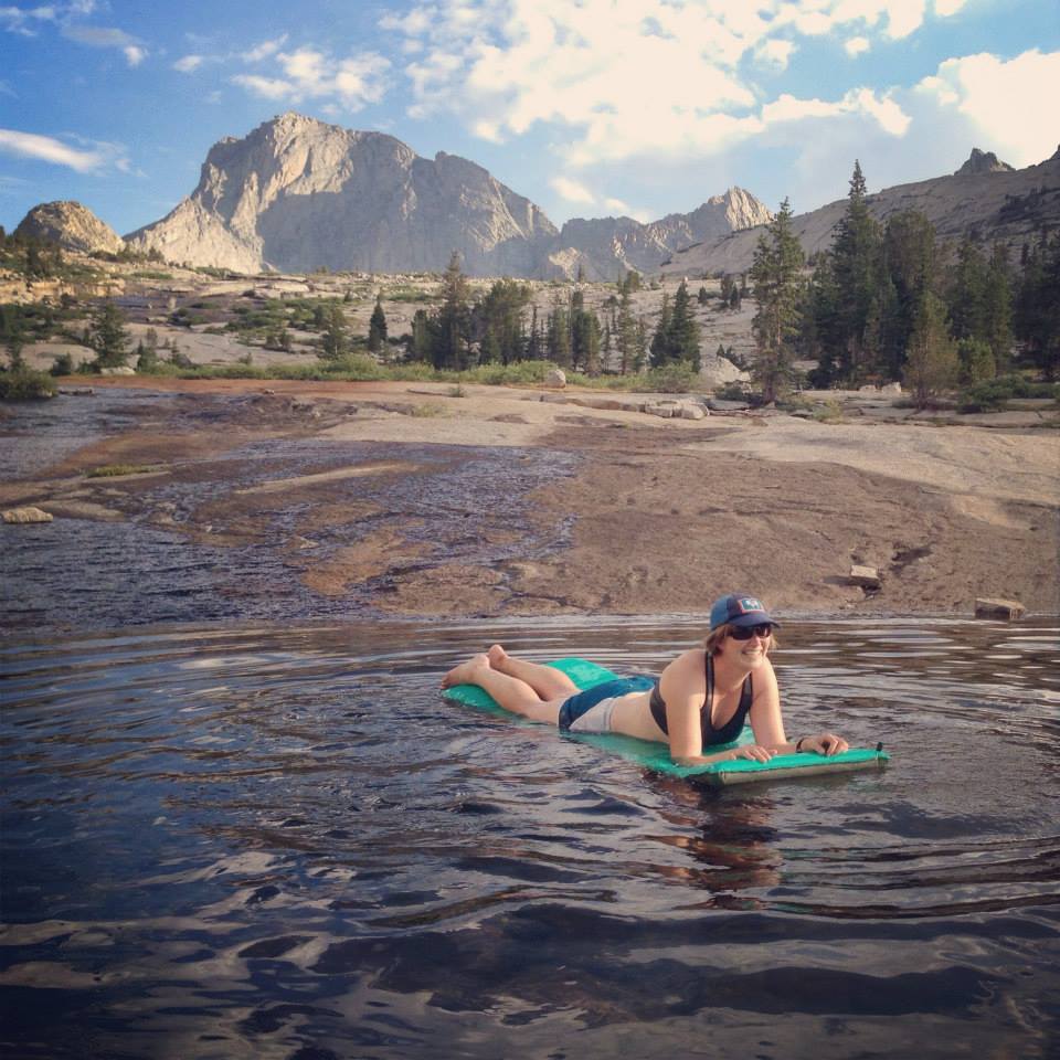
There is a lot at stake in the state’s plan to reclassify more than three-quarters of its streams to allow for levels of E. coli that would be unhealthy for swimming and playing. We think this plan in its current form is flawed, but we also see a path forward for improvement.
From our conversations with the Wyoming Department of Environmental Quality, we understand that this effort was an attempt to appropriately classify “low flow” waterways where outdoor recreation such as swimming, floating, playing, and cooling off in the water is not expected to take place.
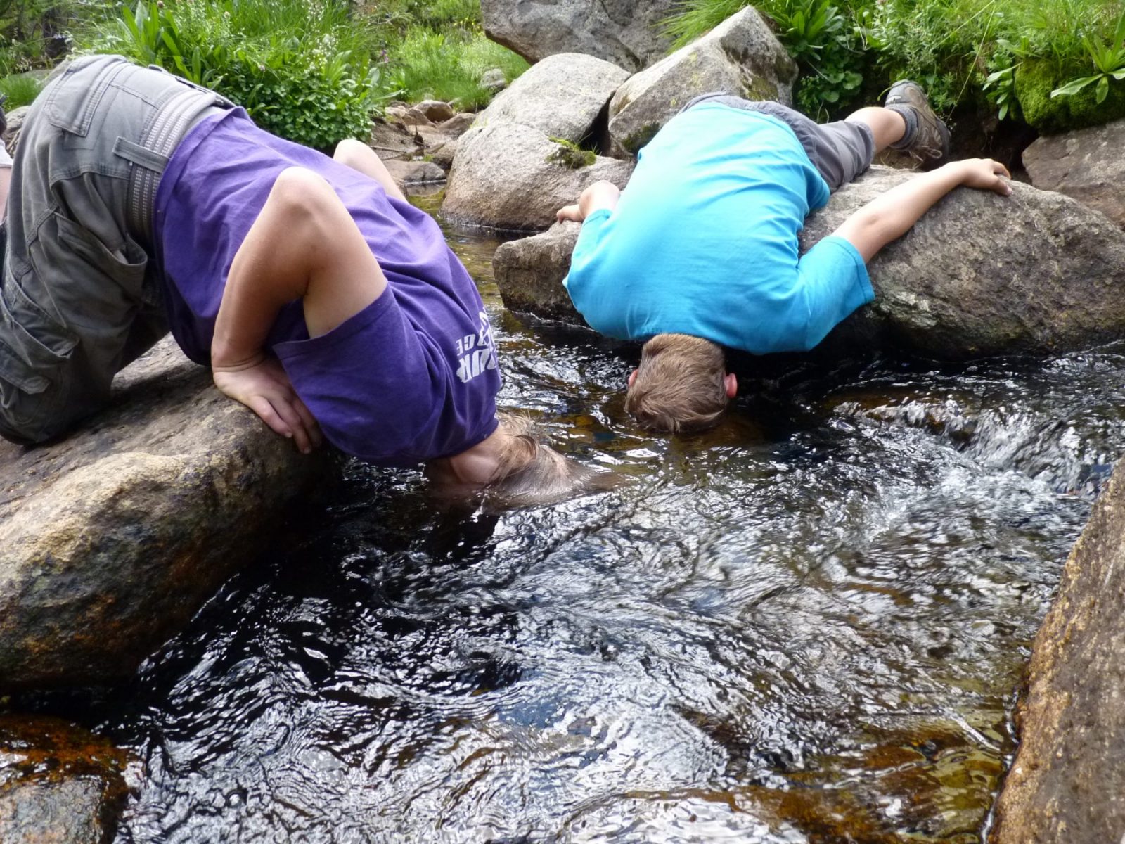
We understand the impetus behind this decision and, in the abstract, it makes some sense. There is no reason that many ephemeral streams and dry draws in Wyoming should be managed as “primary contact” recreation waters when they clearly are not used for recreation.
But the problem that the Wyoming Outdoor Council and many citizens and recreation groups have with this plan is that it uses a model to reclassify streams that inappropriately downgraded lots of waterways that people actually use for recreation, especially in the summer months—including in the mountains, and on national forests.
So where do we go from here? We think there is a solution—a middle ground—where the model can be improved to better protect recreational values and comply with the Clean Water Act.
Here are some examples of improvements we’re asking the state to consider:
- Scrap the assumption that people will not walk more than a half-mile from a trailhead or a mile from a population center to play in the water. Thousands of people hike for miles and miles in Wyoming every year, especially during the summer months.
- If we are really trying to address low flow waters, then make this rule more about low flow waters. Setting the standard below the current mark of 6 cfs just makes sense and it would help prevent unintended downgrades.
- Protect places like wilderness areas. I bet we can all agree that there are places on our public lands that support recreation and tourism and those places should maintain the highest standards for water quality. If primary contact recreation isn’t an attainable use in wilderness then we’ve really blown it as stewards of clean water.
- Rather than using the average annual flow of mountain streams to determine whether primary contact recreation is an “attainable use,” use instead more appropriate seasonal flow data for the summer months, when the snowpack runoff is at its peak (when outdoor recreation is also at its peak).
- Acknowledge that roads and hiking trails aren’t so different. Access to the state’s waters isn’t always at the end of a street, and the streams located near the state’s trail corridors are just as important as the local swimming hole.
Wyoming took on a lot when it launched this effort to appropriately classify all of the state’s surface waters with a one-size-fits-all rule. And while the new plan removes some real challenges for industry, agriculture, and the state’s regulators, it missed the mark in maybe the most important way. This was a reclassification for recreational use—and the current plan doesn’t capture all the ways that Wyoming people and visitors to our state recreate.
Let’s fix the problem. The Wyoming Outdoor Council believes there is a way forward and we hope the state will incorporate our suggestions as well as those of everybody who cares about these recreational values in Wyoming. We are encouraged that the state recently agreed to accept public comments on this rule. Let’s make the most of this opportunity. There will be a hearing on this proposal in Casper on September 16. We encourage everyone who wants to participate to get your comments to the DEQ either at that meeting or prior to it via mail or fax. If Casper is inconvenient, you might also request a hearing in your local community.
You can fax or mail written comments to the Wyoming Department of Environmental Quality by directing them to David Waterstreet at 307-777-5973 (fax), or 122 W. 25th St. Herschler Bldg. 4W Cheyenne, WY 82002.
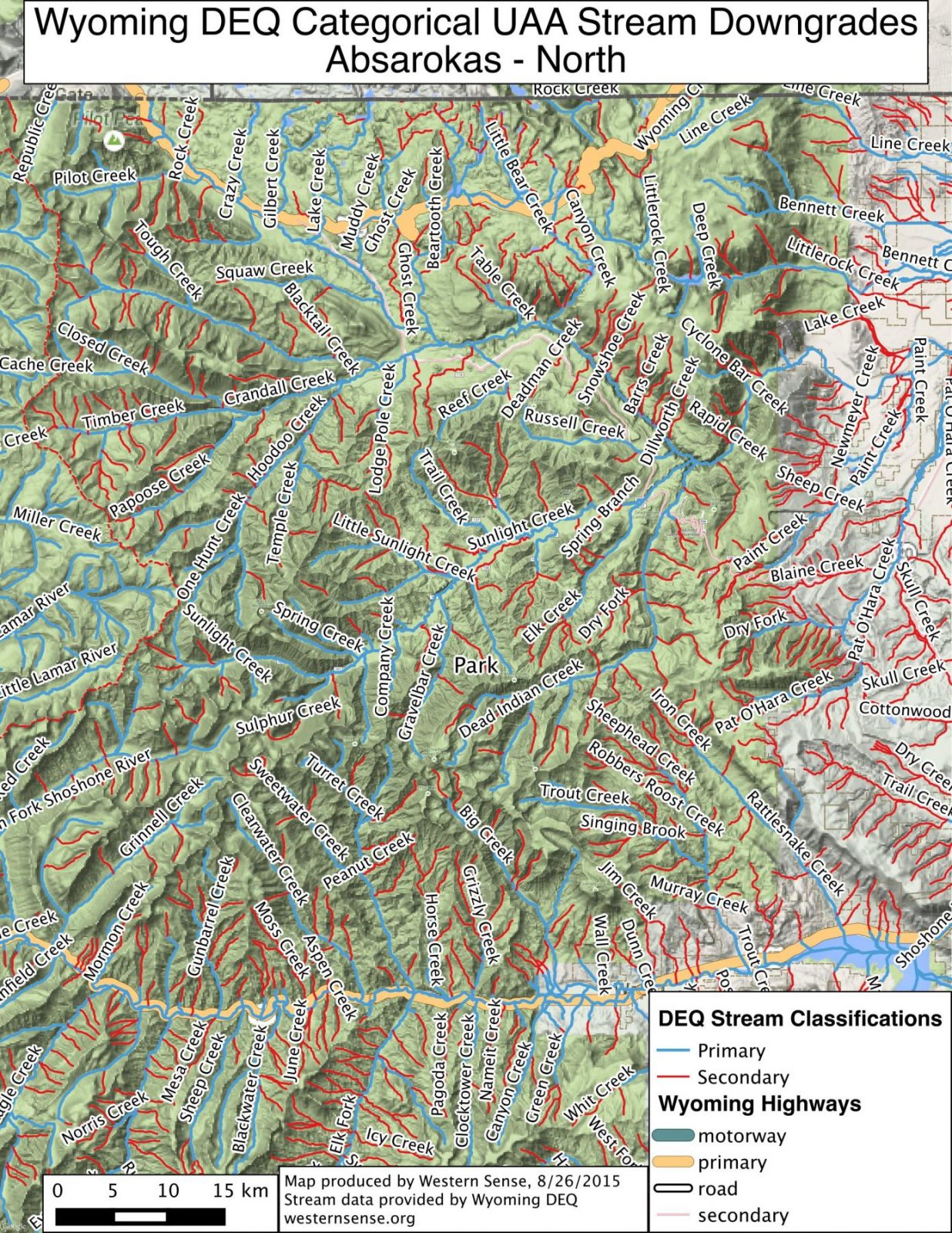
Maps of the reclassified (downgraded) streams
Absaroka Range: North | Central | Southeast | Southwest
Bighorn County
Johnson County: North | South
Natrona County: North | South
Sheridan County: East | West
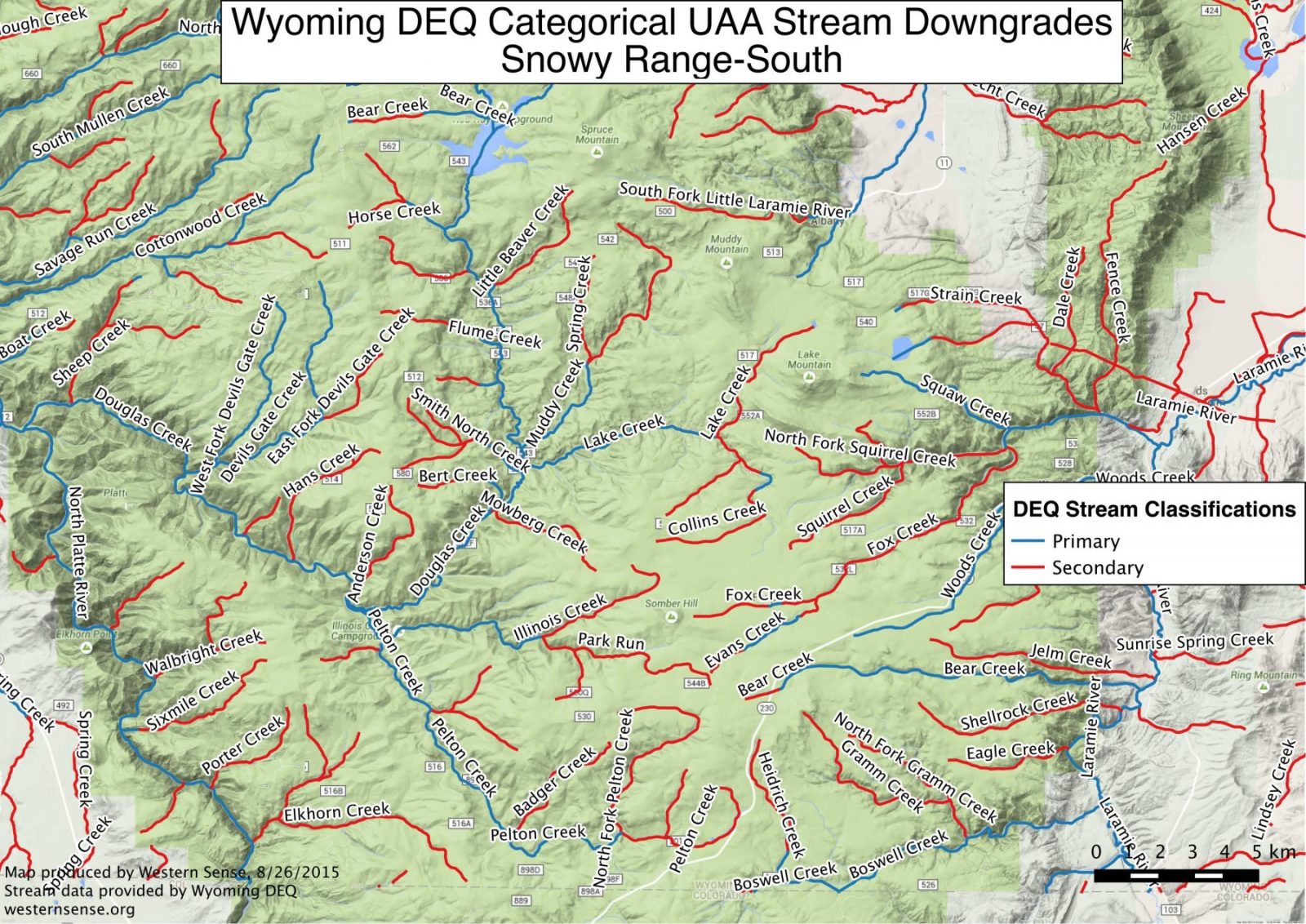
Snowy Range: Overview | North | Central North | Central South | South
Vedauwoo and Curt Cowdy State Park Area
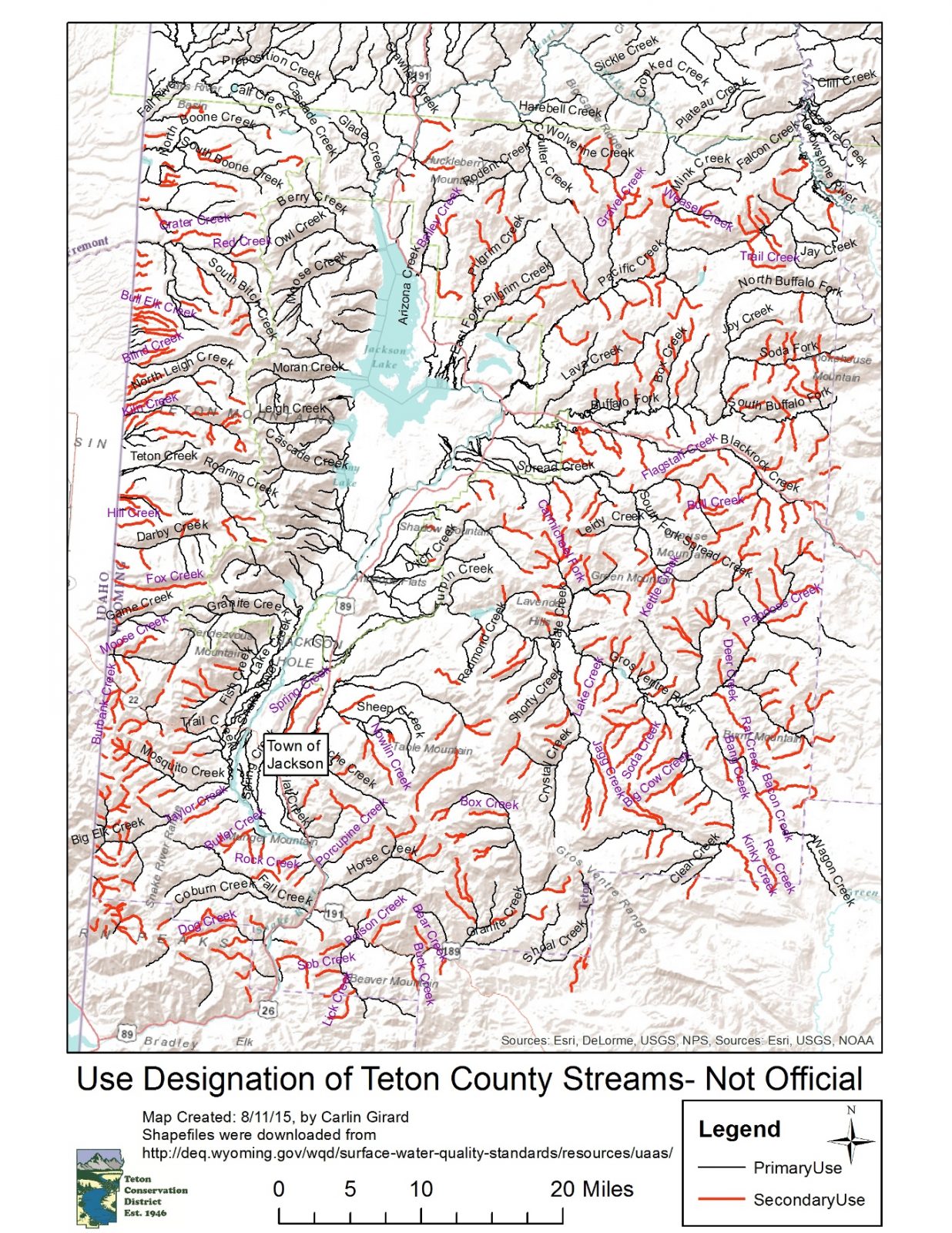
Teton County
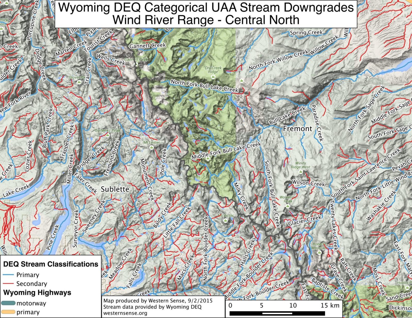
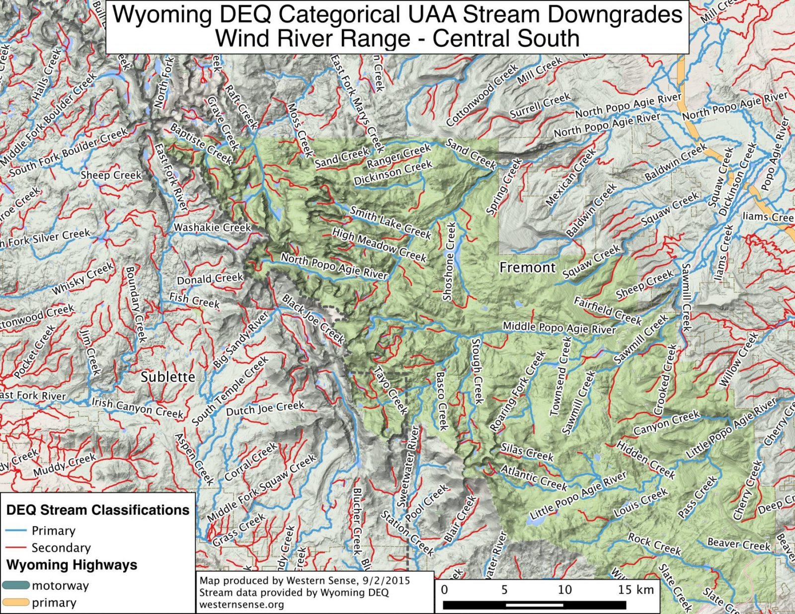
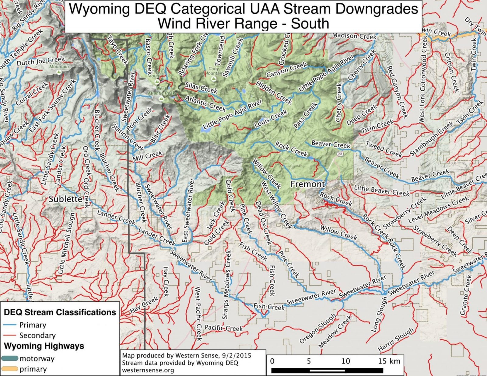
Wind River Range: North | Central North | Central South | South
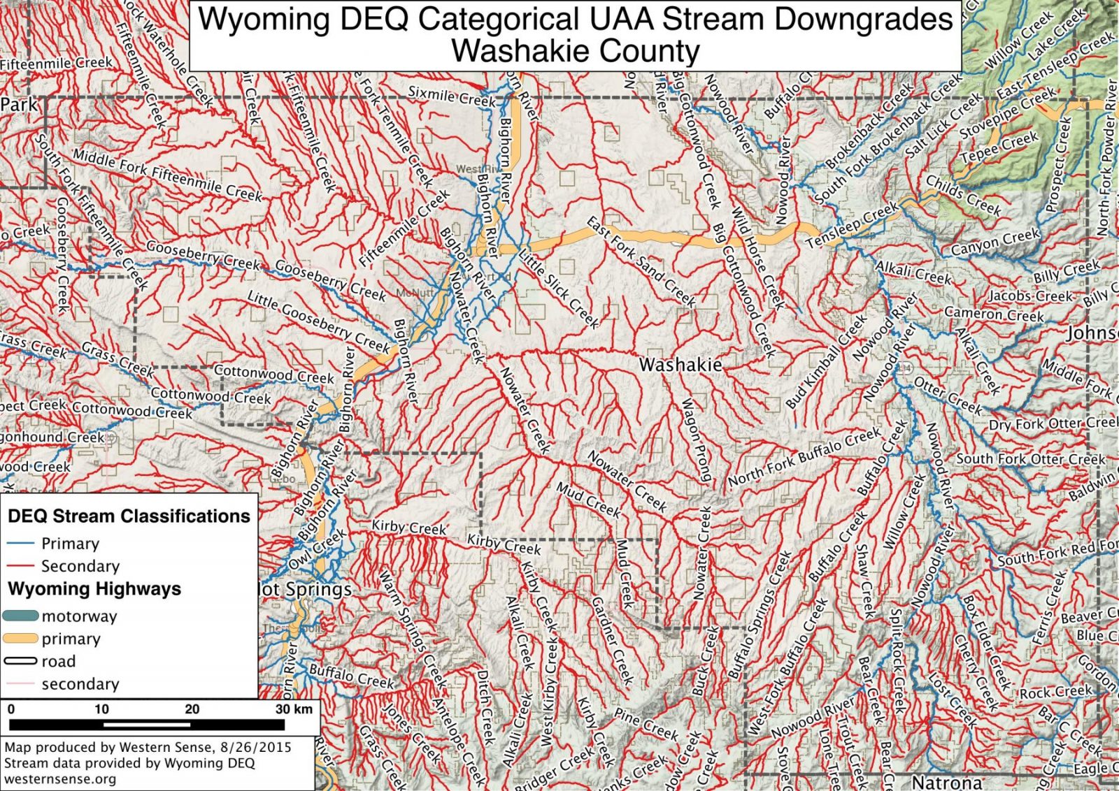
Washakie County
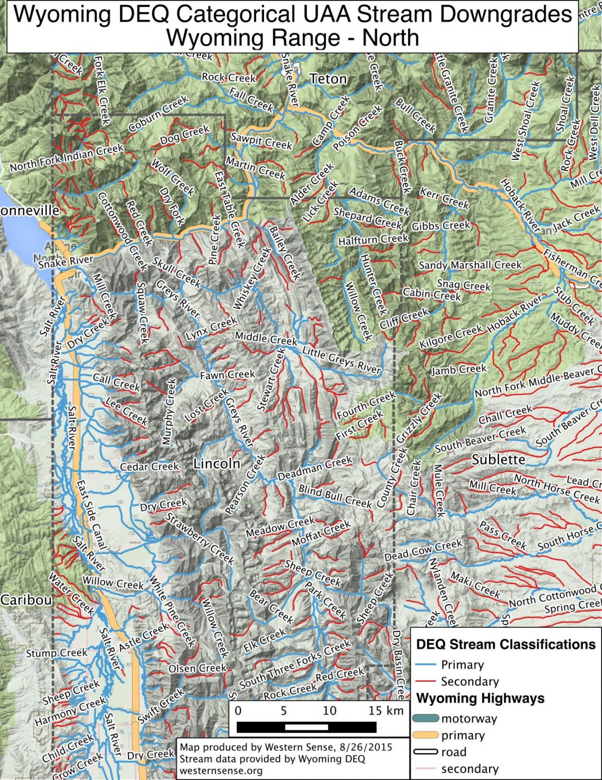
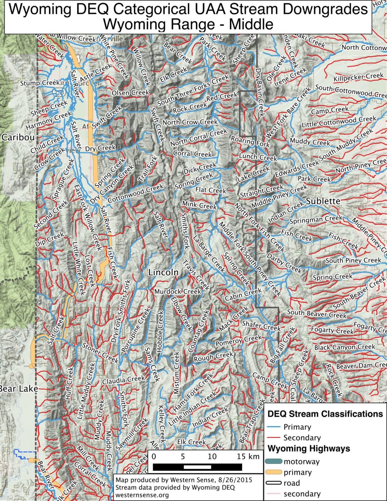
Wyoming Range: North | Central | South
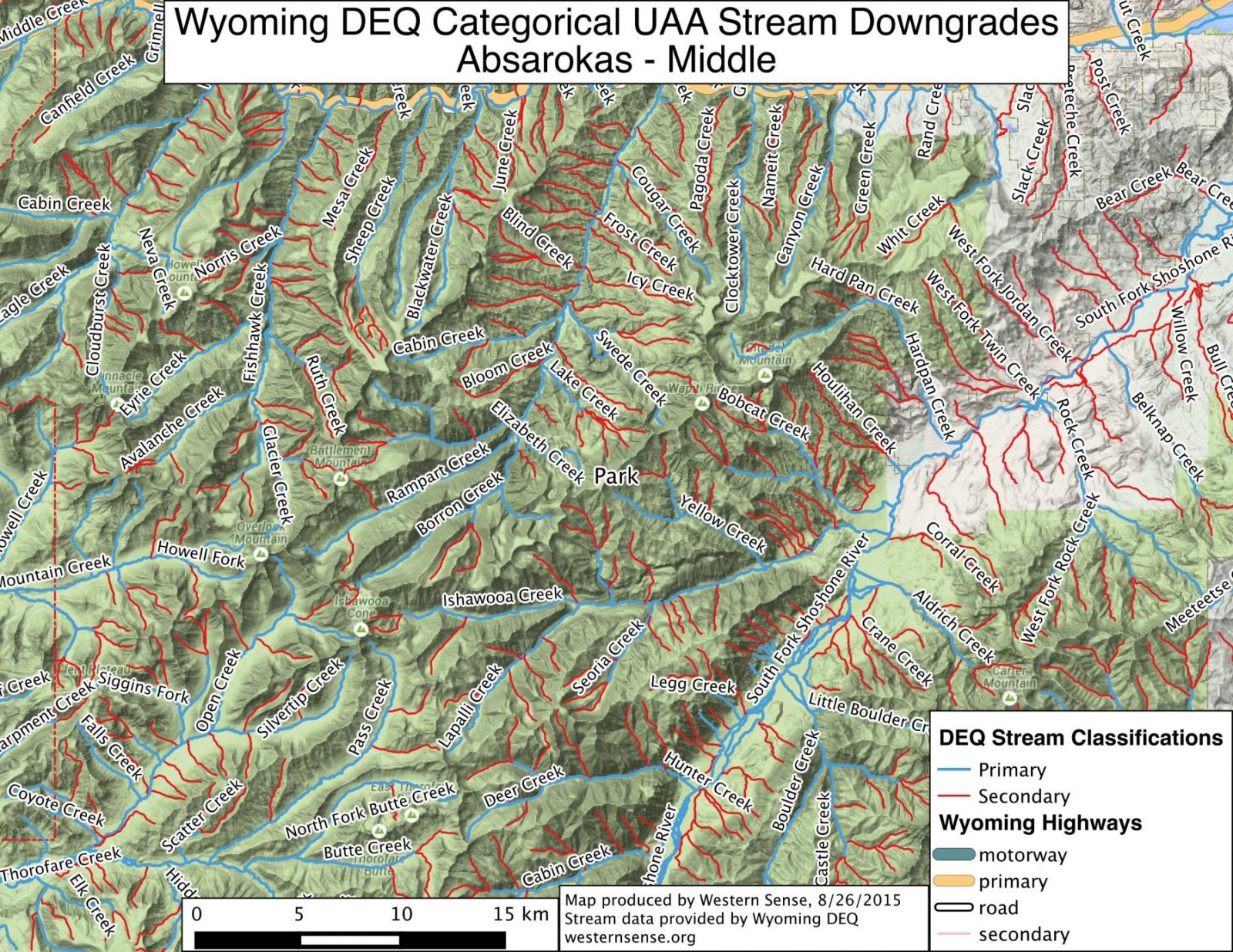
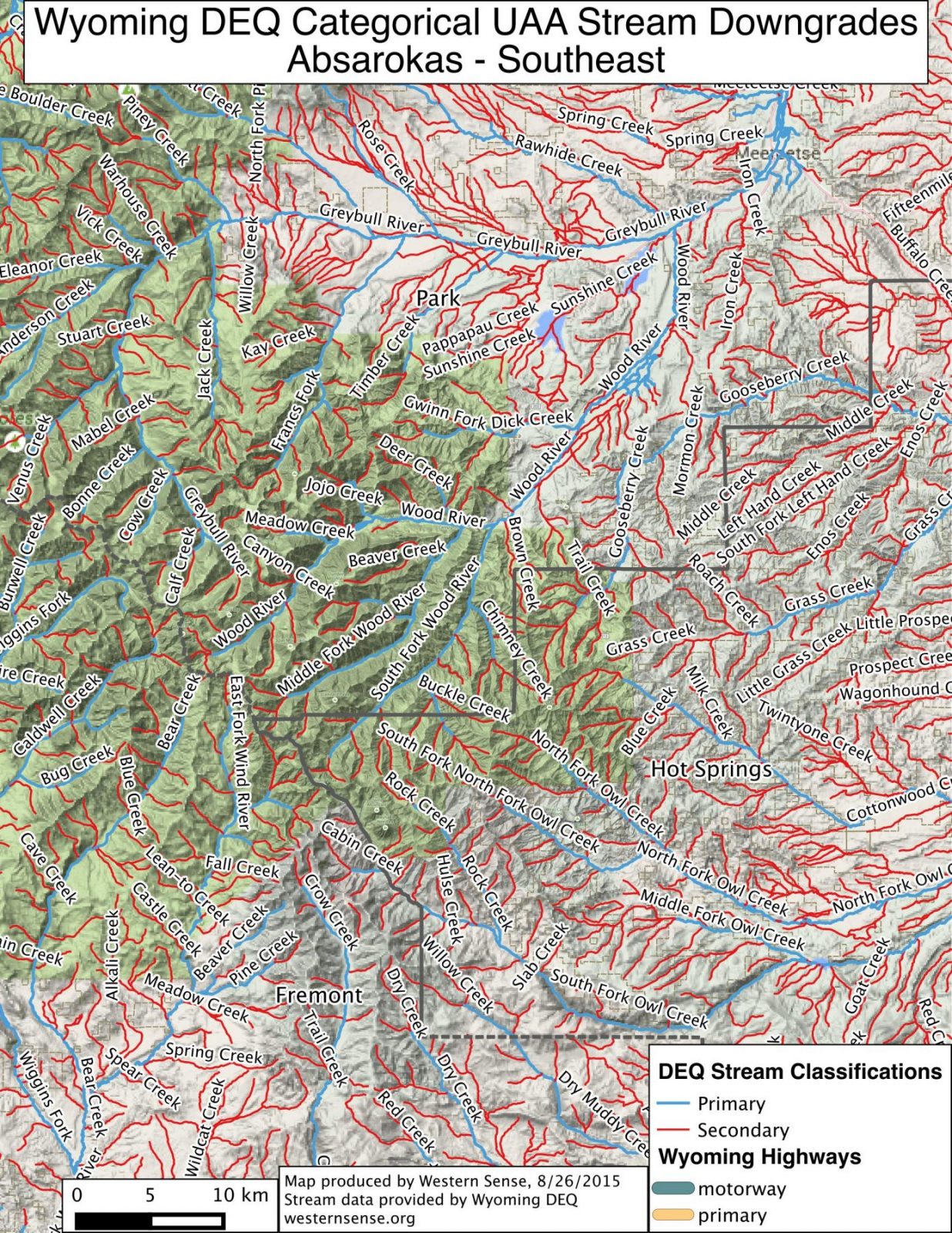
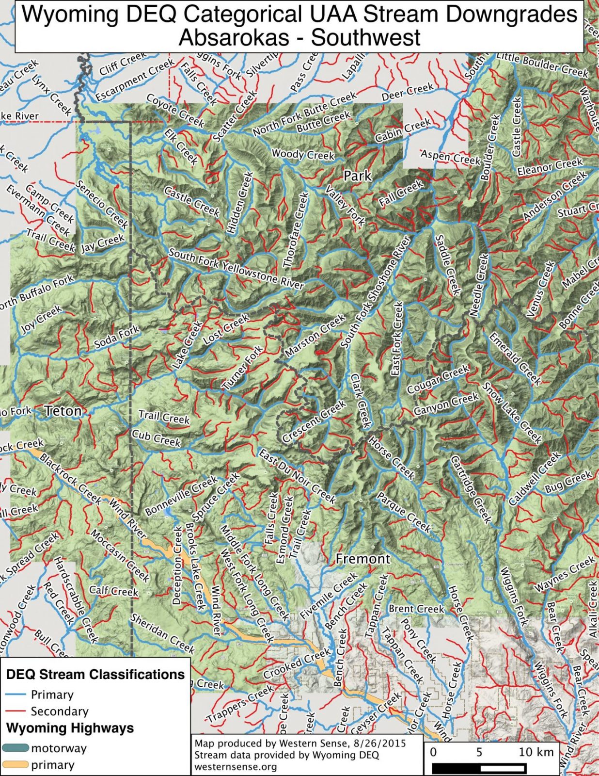
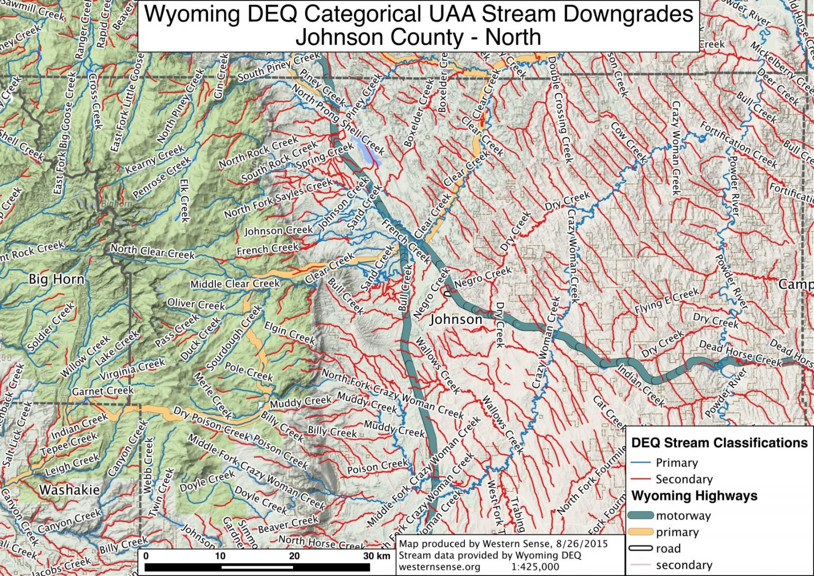
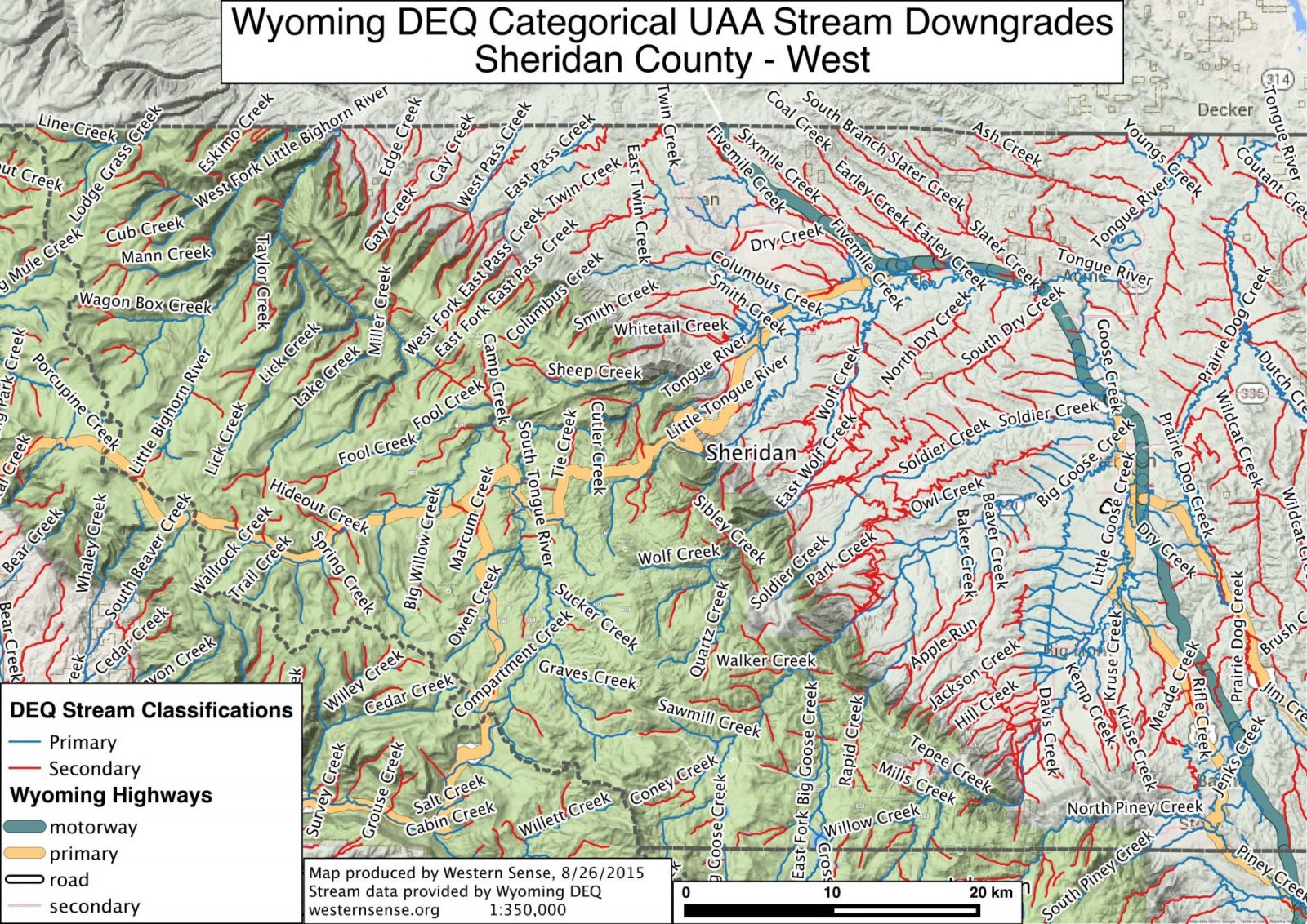
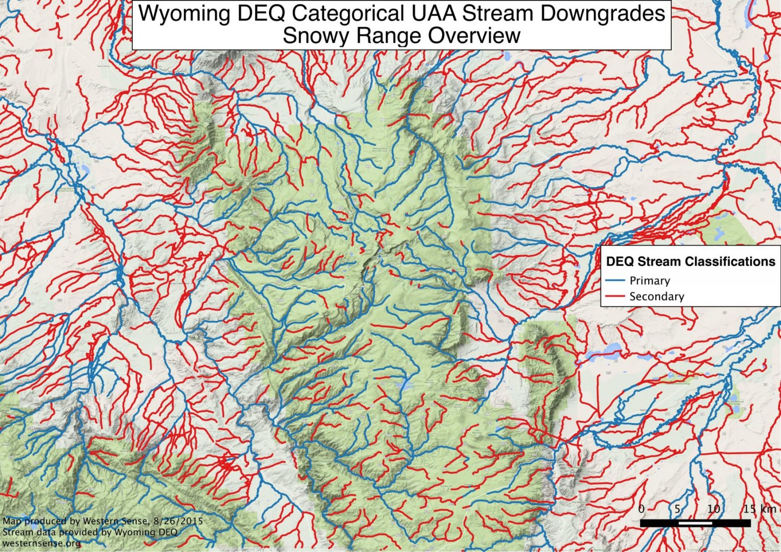
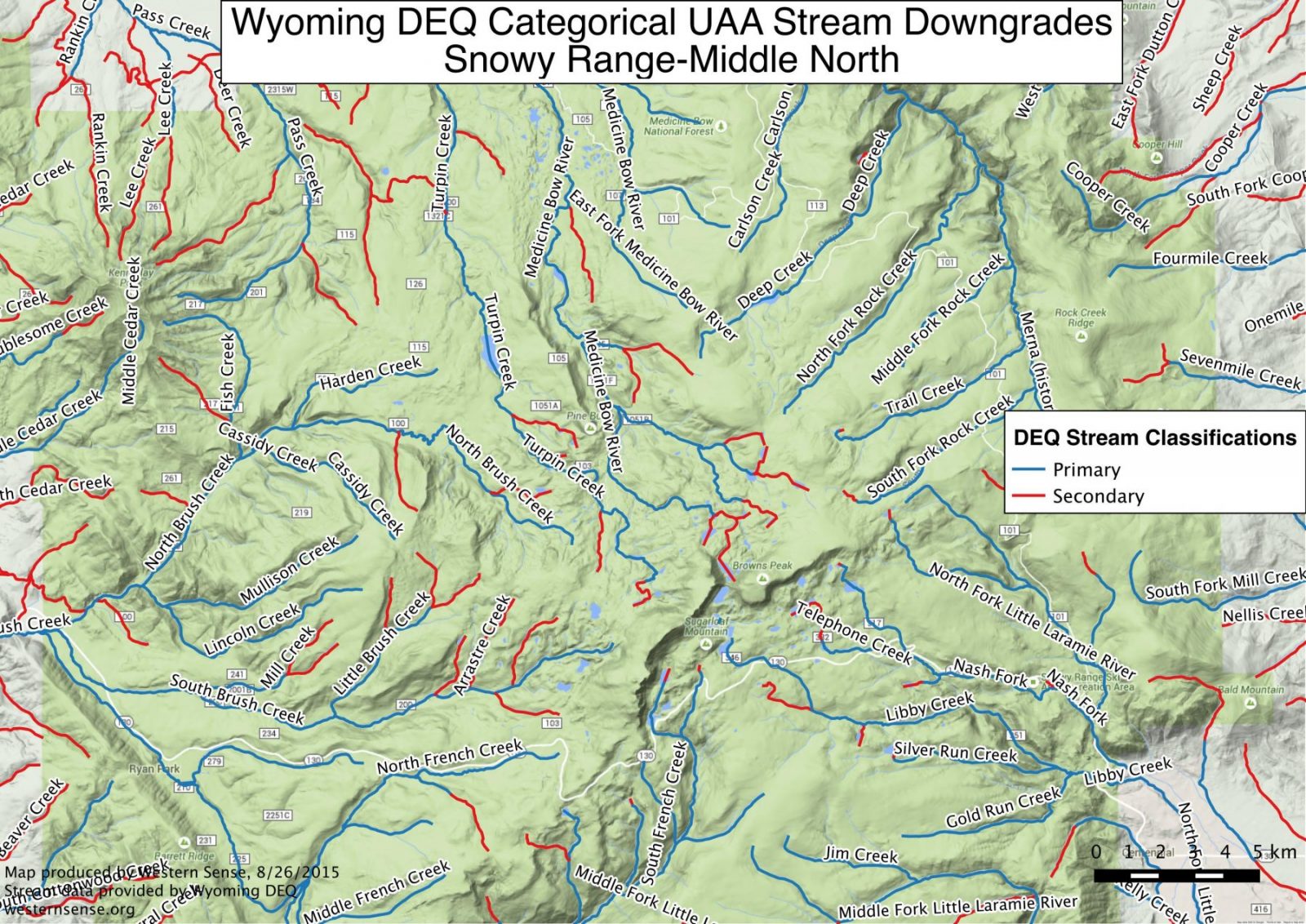
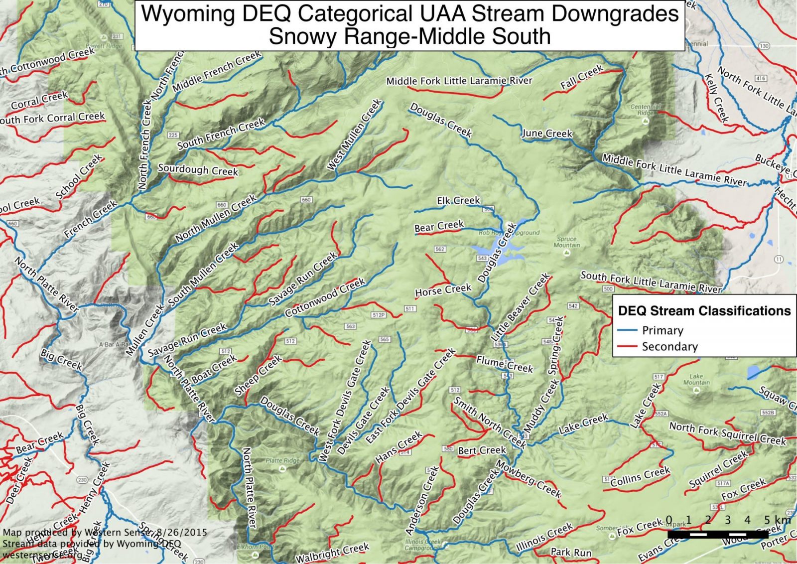
Click on the image or do a “save as” for a larger, easier-to-view image.
Absaroka Range North
Absaroka Range Central
Absaroka Range Southeast
Absaroka Range Southwest
Bighorn County

Johnson County North
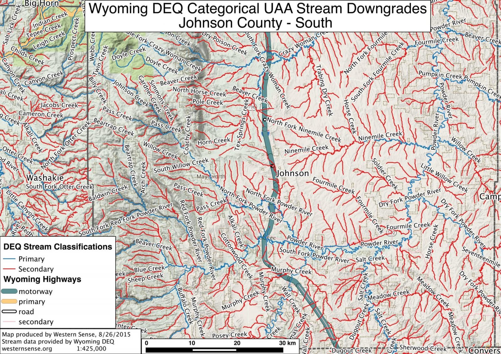
Johnson County South
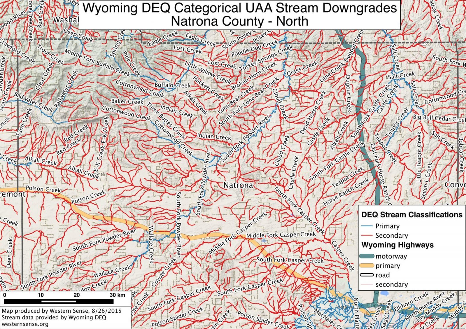
Natrona County North
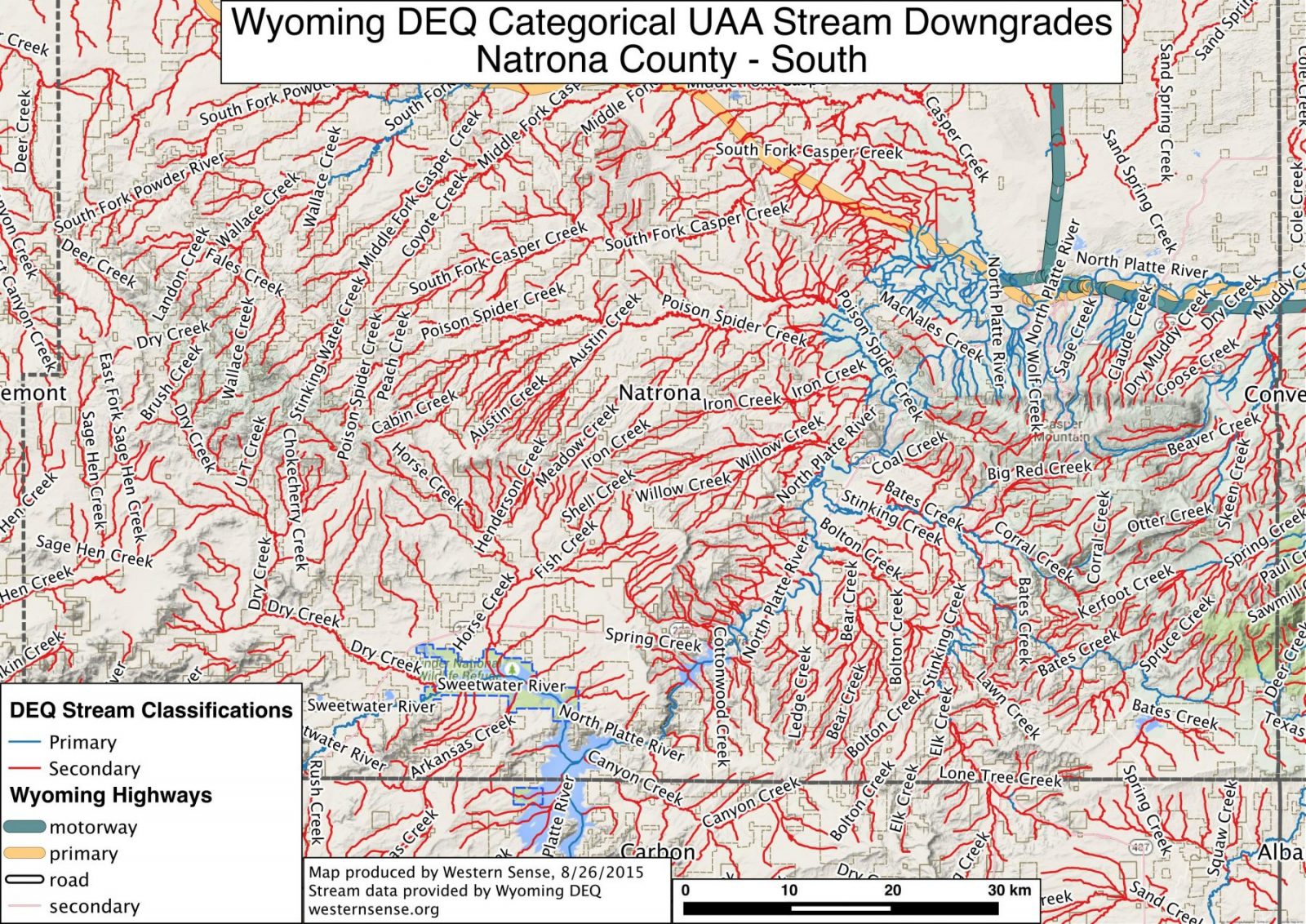
Natrona County South
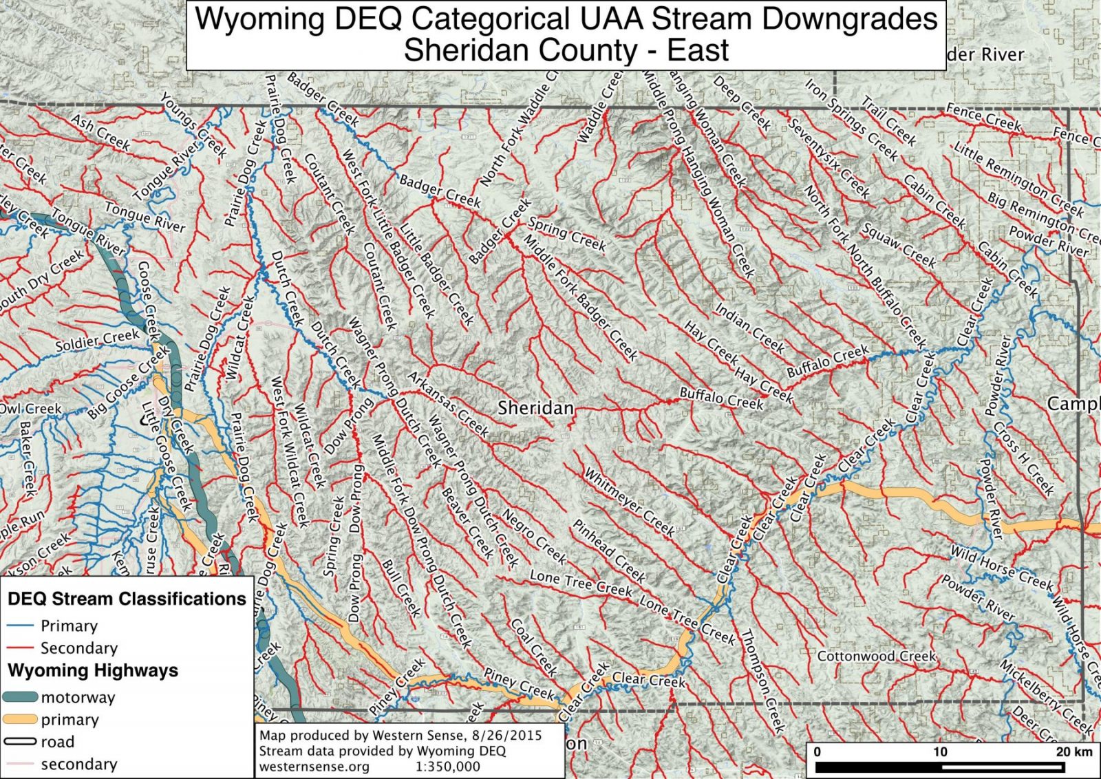
Sheridan County East
Sheridan County West
Snowy Range Overview
Snowy Range North

Snowy Range Central North
Snowy Range Central South
Snowy Range South
Teton County
Vedauwoo and Curt Gowdy State Park Area

Wind River Range North

Wind River Range Central North
Wind River Range Central South
Wind River Range South
Washakie County
Wyoming Range North
Wyoming Range – Central
Wyoming Range South
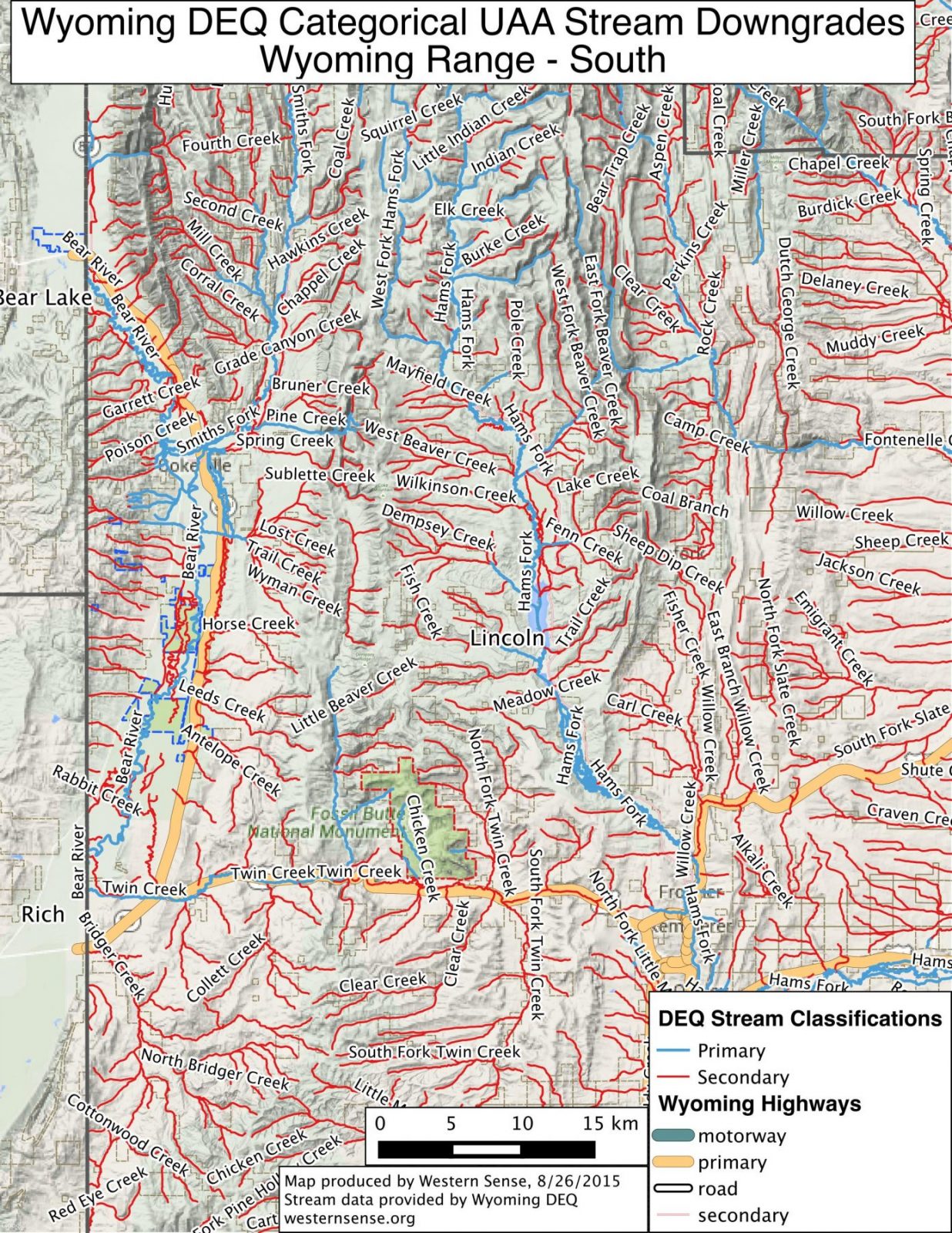
All maps except for the Teton County map were produced by Western Sense using stream data provided by the Wyoming Department of Environmental Quality. The Teton County map was produced by the Teton Conservation District (source here).
You can fax or mail written comments to the Wyoming Department of Environmental Quality by directing them to David Waterstreet at 307-777-5973 (fax), or 122 W. 25th St. Herschler Bldg. 4W Cheyenne, WY 82002.
Gary
Wilmot
Executive Director
Staff